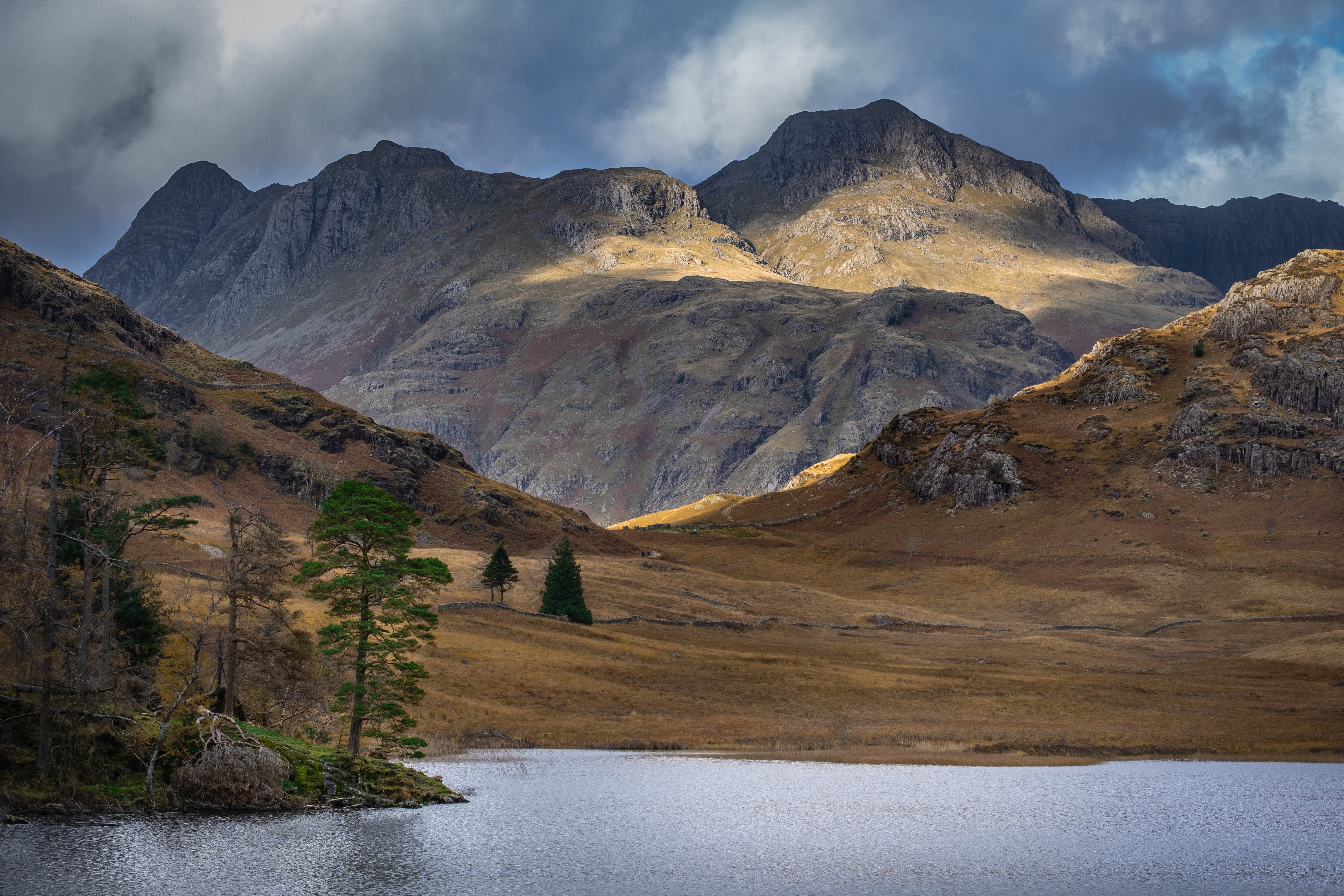
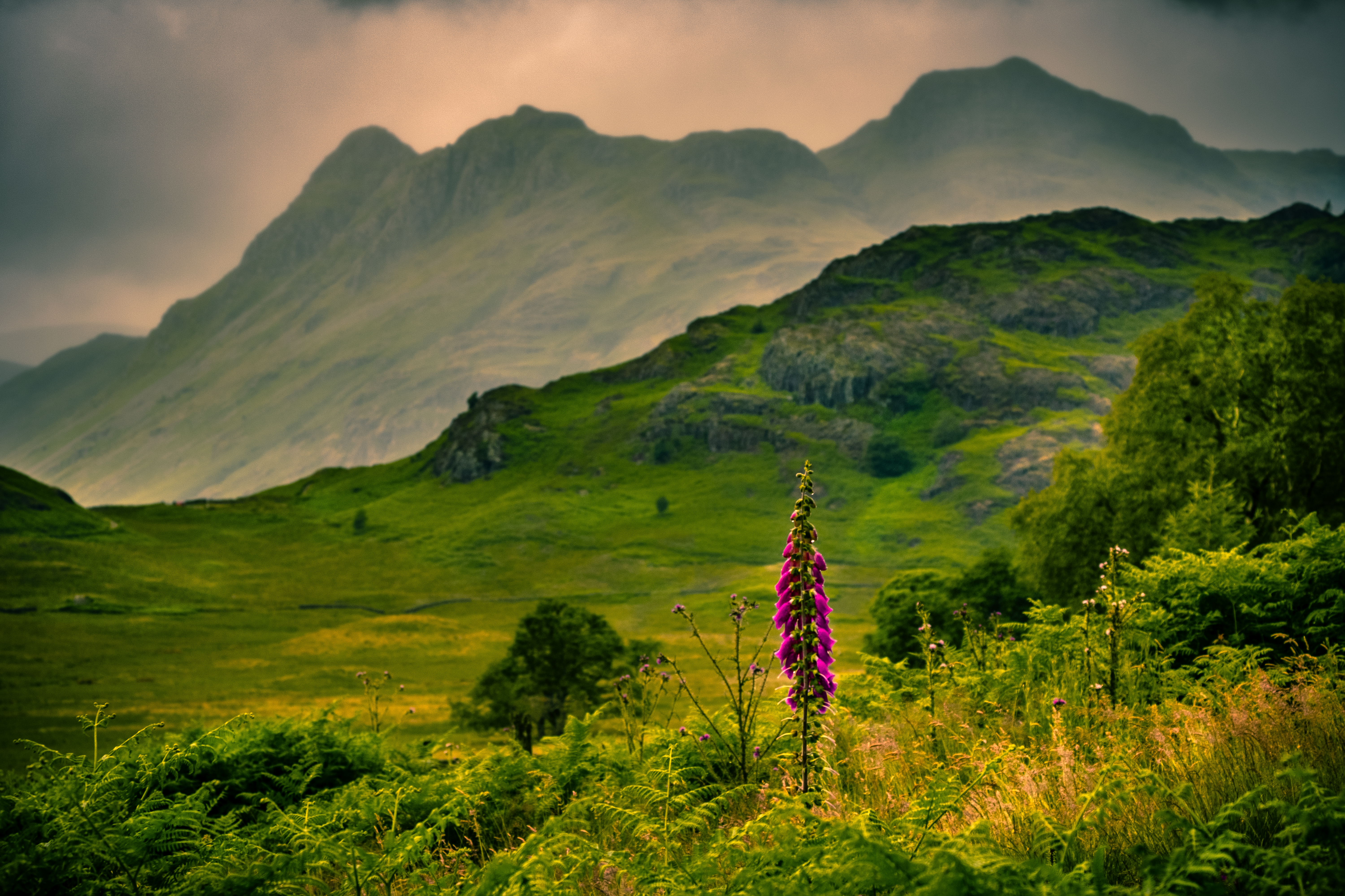
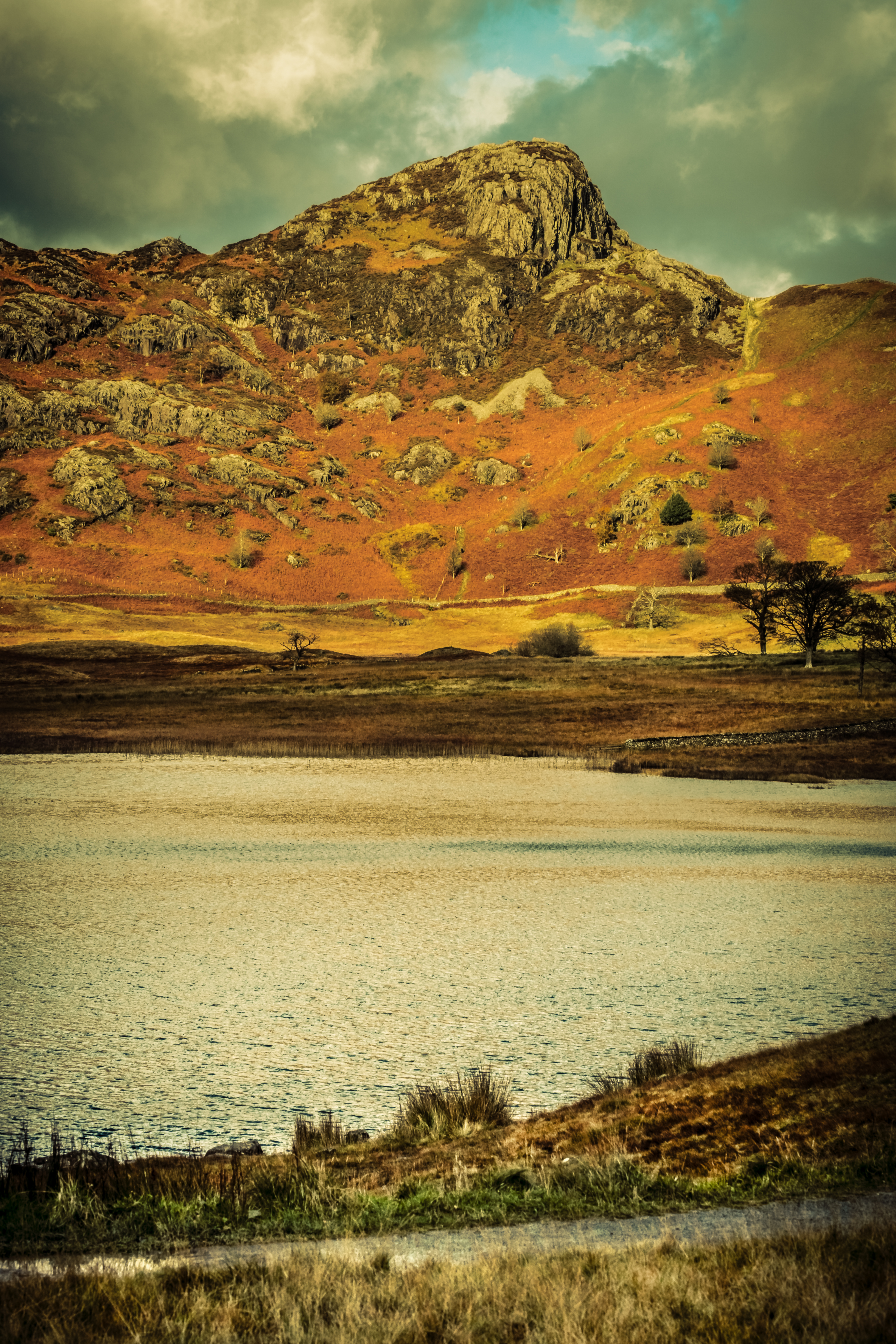
SPECTACULAR – No other word does justice to the classic view from Blea Tarn toward the Langdale Pikes looming up in the distance.
This walk is short, only 3 km, and presents zero navigational issues. What it lacks in distance it compensates for with a wonderfully scenic experience. In my opinion it is best undertaken on days where the hilltops can be seen.
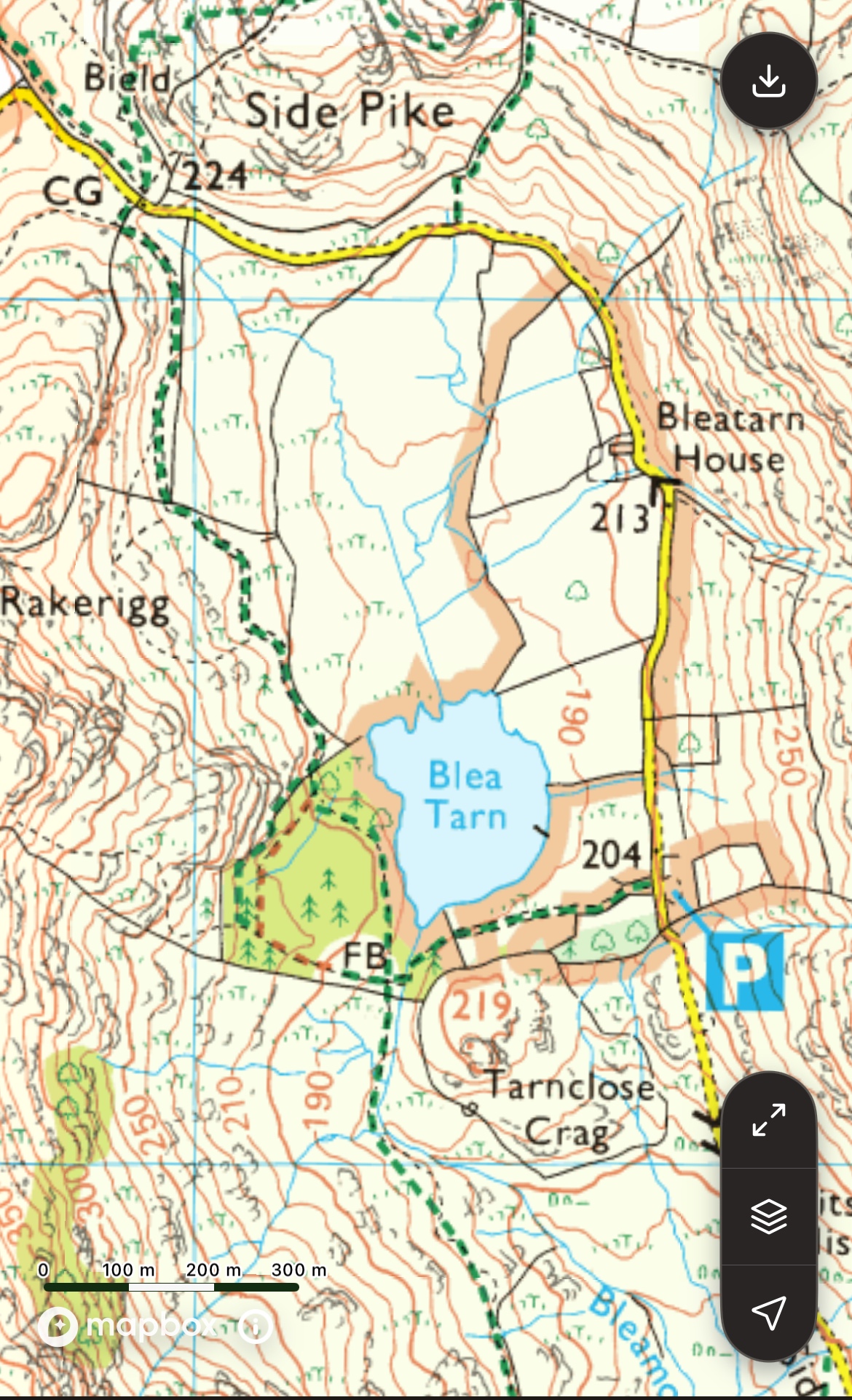
Ordnance Survey Map OL6 The English Lakes (South-Western area) Scale 1:25 000 – 4cm to 1km
Travel by car to Blea Tarn
The car park at Blea Tarn entails some difficult driving up narrow twisting roads, often single track with tiny passing places.
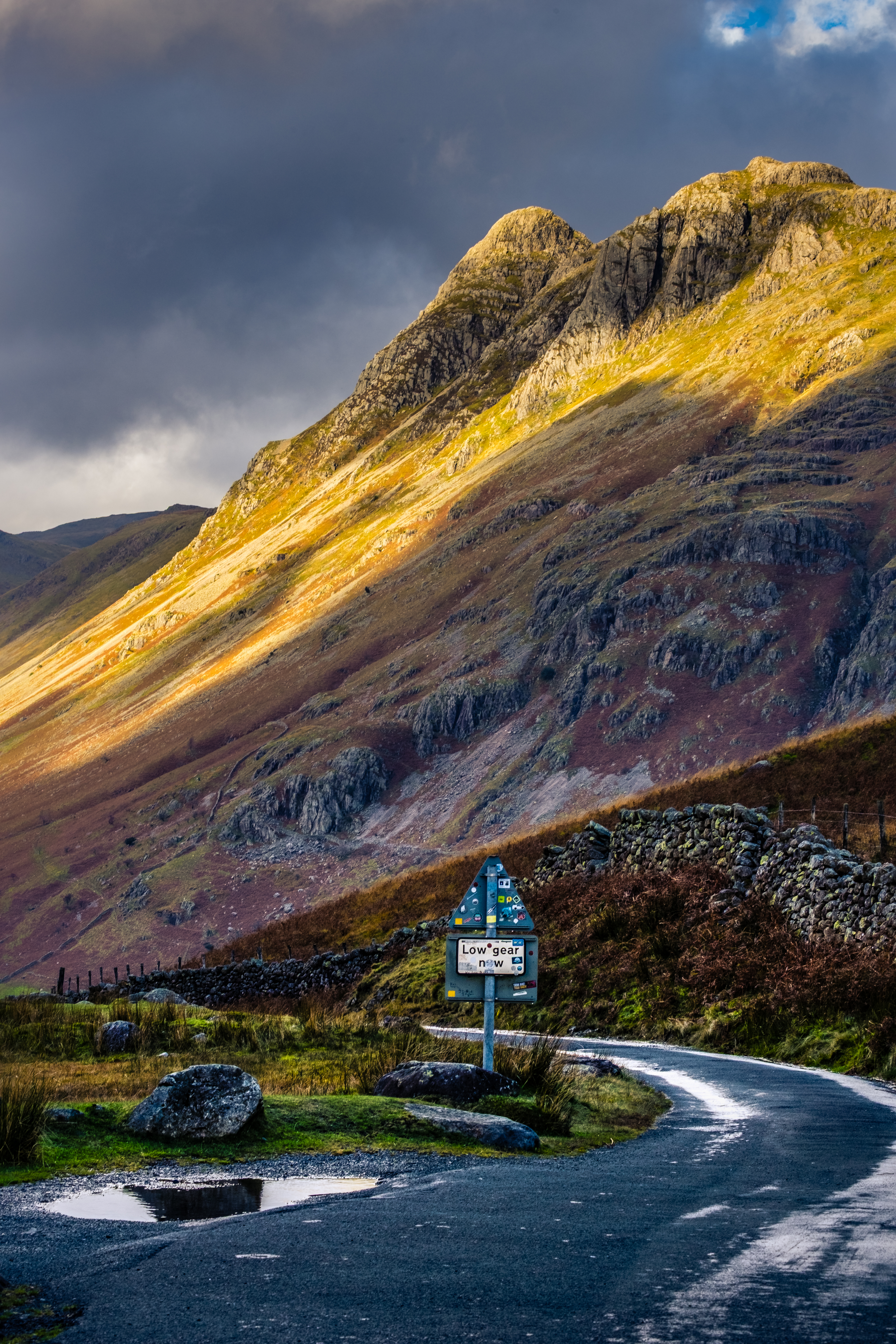
From Ambleside travel west on the Langdale road until you reach the end of the main road at Middle Fell Farm and The Old Dungeon Ghyll Hotel (last chance to grab some refreshment). Continue along the narrowing road to Wall End farm where you will realise the next section is a steep, twirling single track (sealed) road soaring up into the sky. Breathe deeply, engage a low gear and proceed with caution.
If you are rubbish at handbrake starts don’t try this … go back to the Old Dungeon Ghyll hotel where there is a sizeable National Trust car park then proceed by Shanks’s pony. Having negotiated the steep snake of a road you will come to a cattle grid where the road flattens out, still narrow but less nerve wracking. After a few minutes you will see the car park on your left.
Note on Car Park – there are no facilities here and for most folk there is no internet connectivity. So trying to pay for parking by phone seldom works and you are advised to pay later in the day when you return to civilisation!
Work around this by joining the National Trust before going, their Trust membership card works in this machine and saves any further anxiety before the walk soothes your soul.
A Tale of 2 Trails and 2 Cattle Grids
The route starts at the small National Trust car park near the tarn. The outward trail from the car park is along the sealed single track road to the cattle grid atop the steep descent into Great Langdale. The return trail southwards and around the west side of the tarn is a wide unsealed stone and gravel track that meanders around the tarn and back to the car park.
Off we go … having packed your rucksack and camera (vital today), laced up your boots and locked the car we are ready to go. I love starting walks and this one has instant impact. At the entrance to the car park look down to the tarn then off to your right toward the Langdale Pikes.
Short Preliminary Detour – Before sauntering along the road to your right I would like you to take a very short detour to your left.
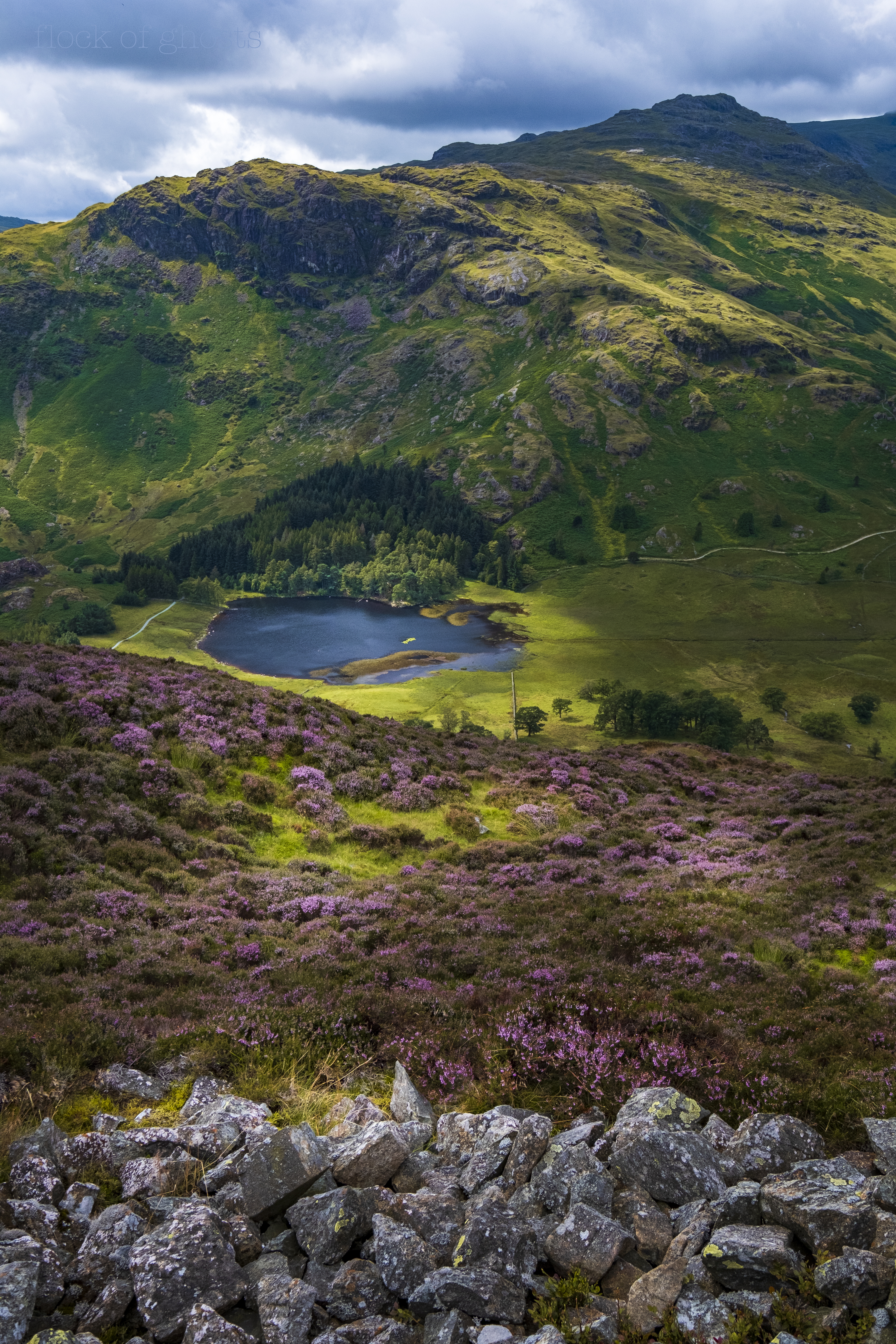
A few yards down this road is a cattle grid which you need to cross with care. On the other side is the faintest of tracks to the right and a tiny knoll where you can gaze down into Little Langdale with numerous mounds and hillocks on display. The larger mountains rising behind to the south are the Tilberthwaite Fells at the northern end of the Coniston ridge – Wetherlam, Swirl How and Great Carrs.
Nearby to the west is a lovely heather clad rocky knob, Tarnclose Crag, with wonderful views over the tarn. I’m not sure if it’s possible to scramble up there nowadays.

Back to the Main Walking Event
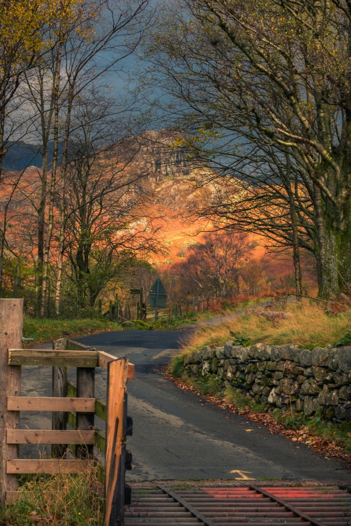
Totter back over the cattle grid and enjoy the easy road walking past the car park. Old dry stone walls to the left and open fell slopes to the right. Traffic will be light and always respectful, however my strategy is to step into the grass and stand still as vehicles pass.
Take your time along this part of the walk. The steep slopes on your right belong to Lingmoor Fell. My favourite time of year in this area is August when the heather is flowering profusely. Ling (meaning heather) absolutely cloaks many hilltops and Lingmoor is a prizewinner.
The tarn is always visible over the wall to your left and and the Langdales will seem huge the closer you get to Bleatarn House. Despite being on a sealed road it feels wonderful to be up high in open country.

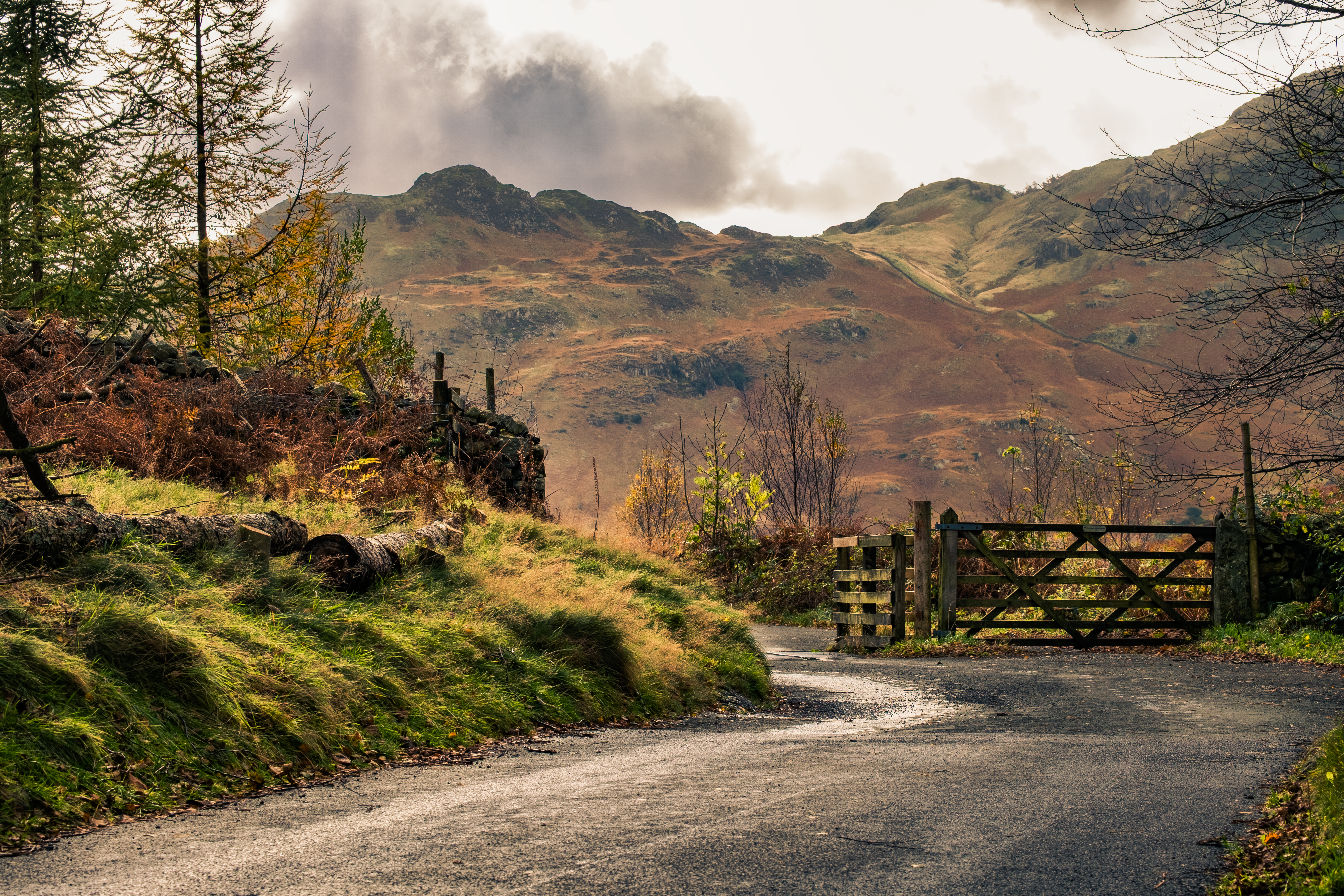
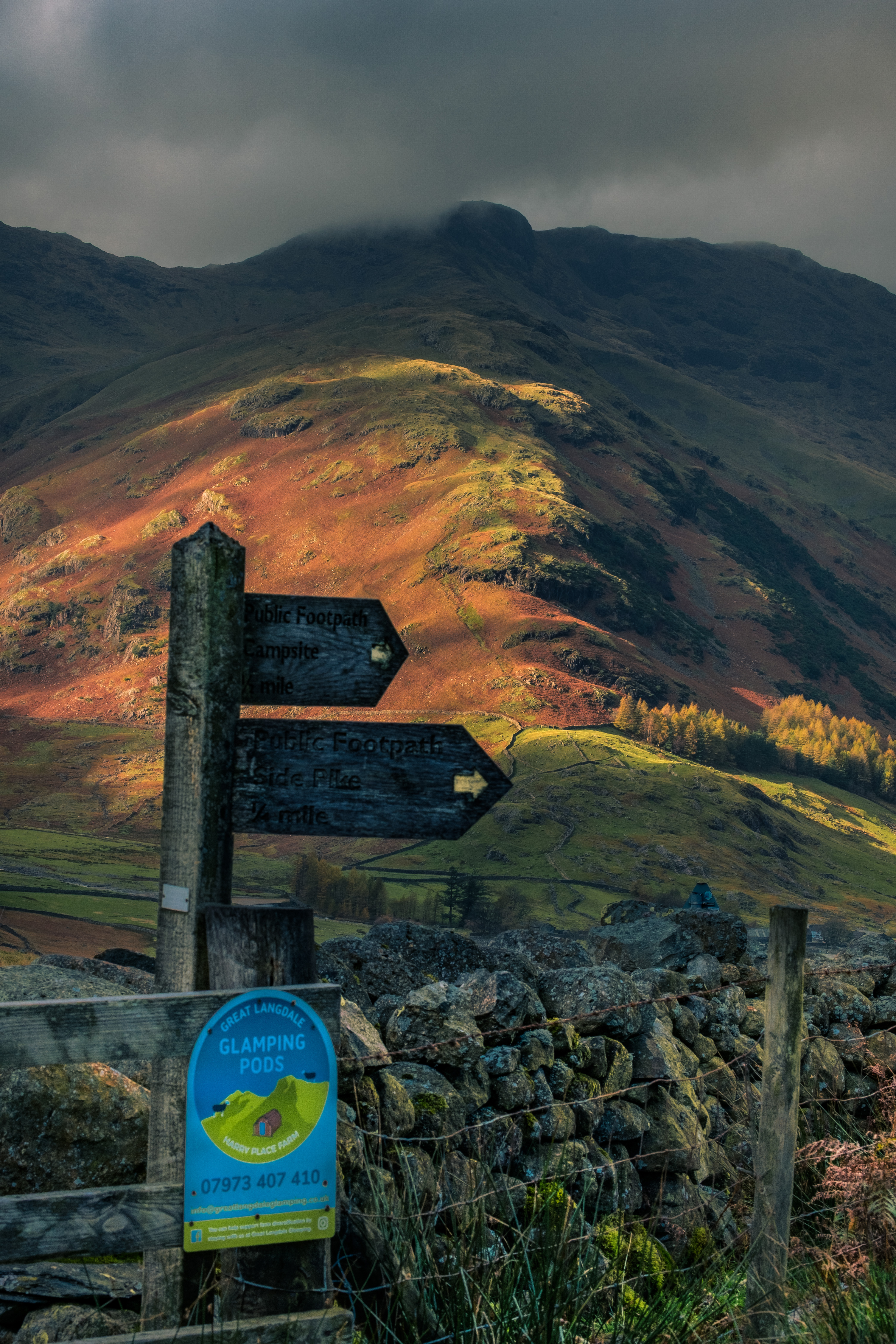
From Bleatarn House your attention will be drawn more toward Side Pike dead ahead. There is a steep path leading up to the col between the rocky summit and Lingmoor Fell, with superlative and classic views from the ridge. I have spent many hours scrambling around the rocky top of Side Pike. For now we are aiming for the cattle grid at the end of the visible road where it plunges down to Great Langdale.
Before you reach the cattlegrid, and turning point on this walk, take some time to look back to the tarn and the Tilberthwaite hills beyond.

Arrival at the cattle grid is likely to coincide with visitors and walkers deciding which trail to follow at the crossroads. It’s also a perfect picnic spot with views in every direction.
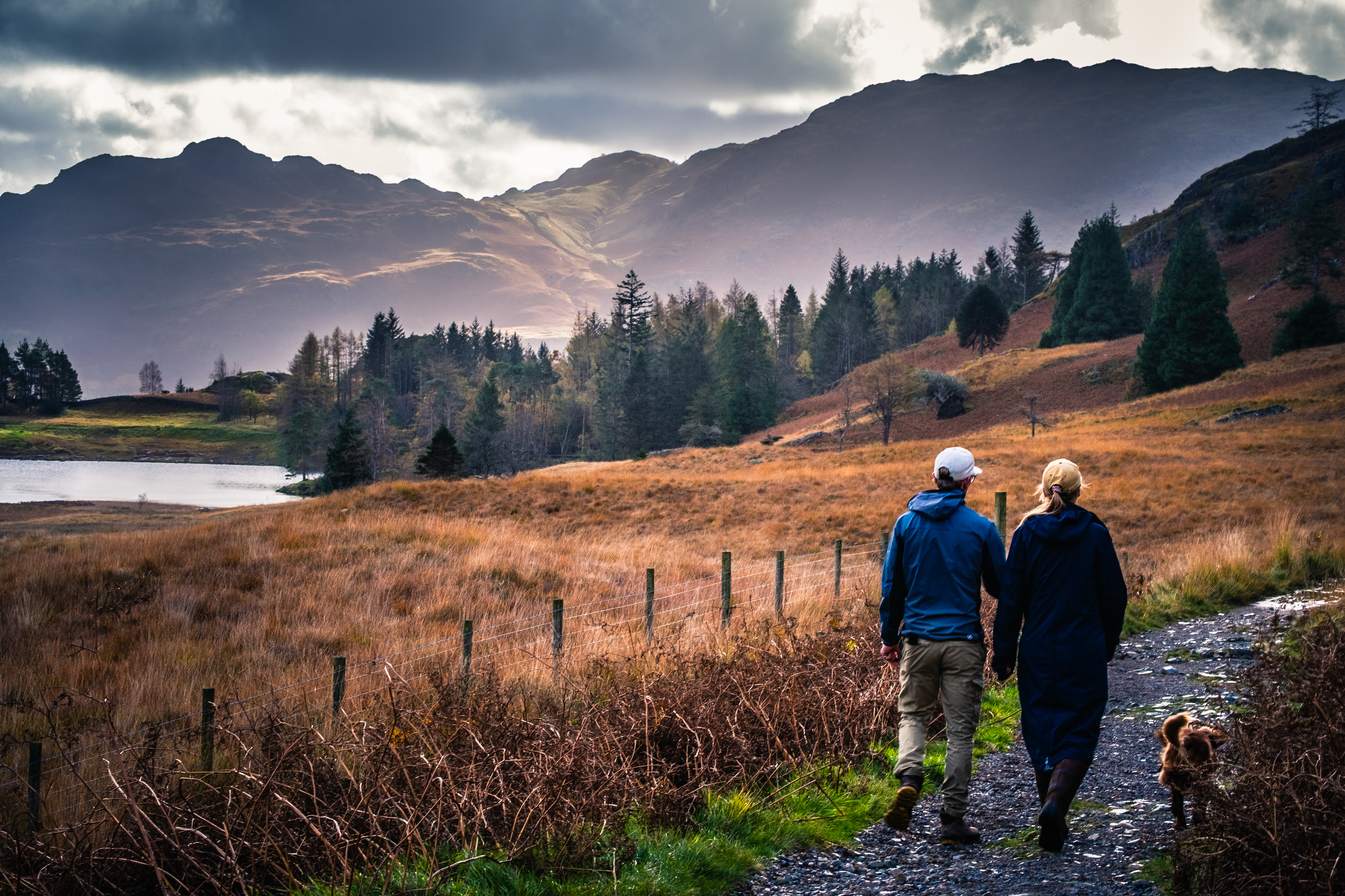
Our route is to the left through a gate onto the wide stony track heading back toward the tarn. Easy walking all the way with the rocky slopes of Rakerigg and Blake Rigg on your right for company. Your attention is naturally focused on the upcoming tarn.
Another gate opens into the woodland where it’s possible to get to the water’s edge. Recently several large trees have come down cluttering up the wood. Despite the destruction it’s an opportunity to see up close and personal the scale of large tree roots and limbs. I can’t imagine how scary it would have been as ferocious gales were needed to rip these giant trees out of the ground.
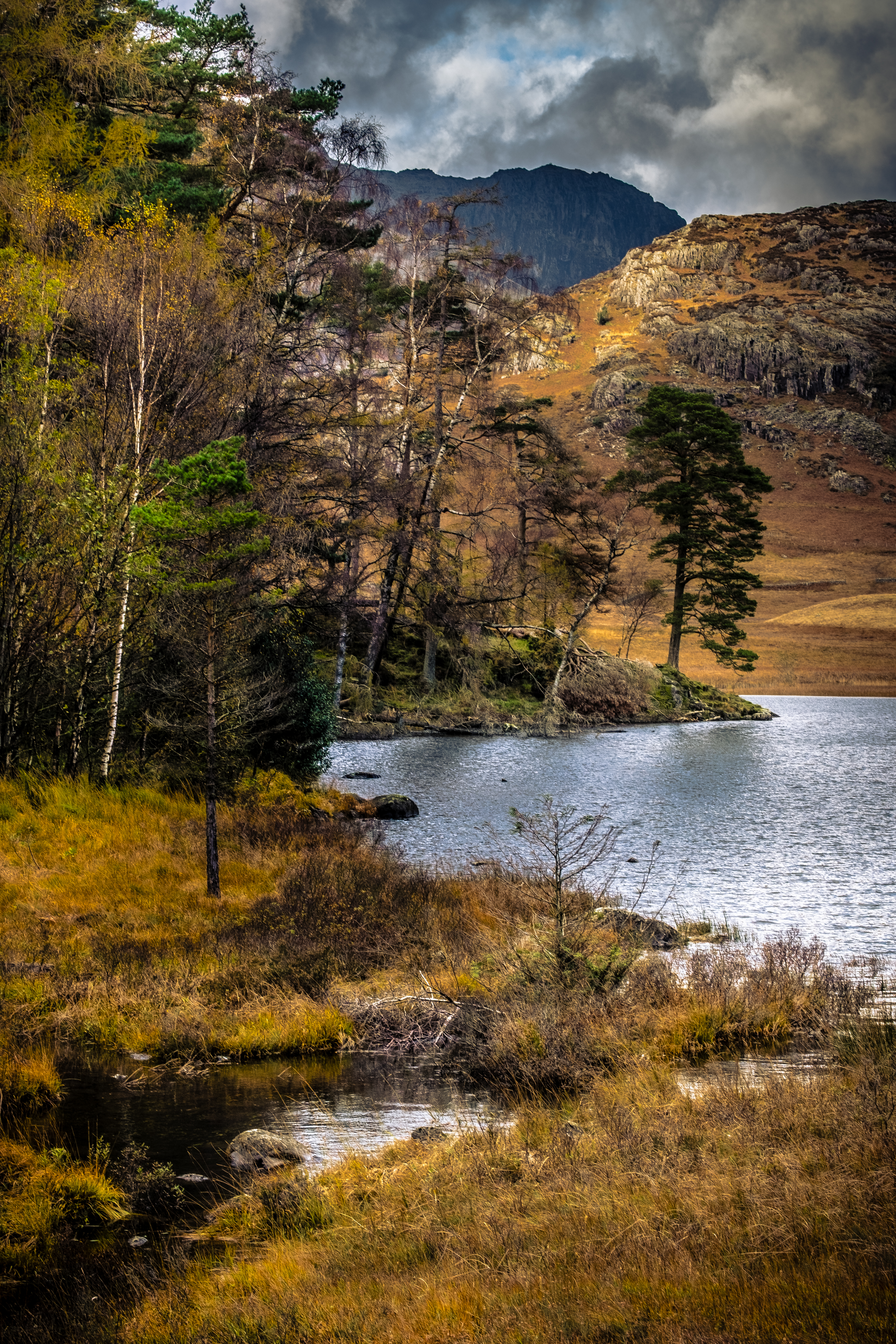
Coming out of the trees at a wooden bridge the track swings around the south side of the tarn with a chance to relax and study the extremely satisfying view over the tarn. It’s worth walking down to the shoreline for a unique perspective on the location.

There are several places to extend the walk along the route, most much more strenuous as they involve scaling high peaks. For me this walk is quite sufficient, in fact it can be difficult on a warm and sunny day to toddle back to the car and leave. Needs must, so it’s goodbye from me. Happy Walking