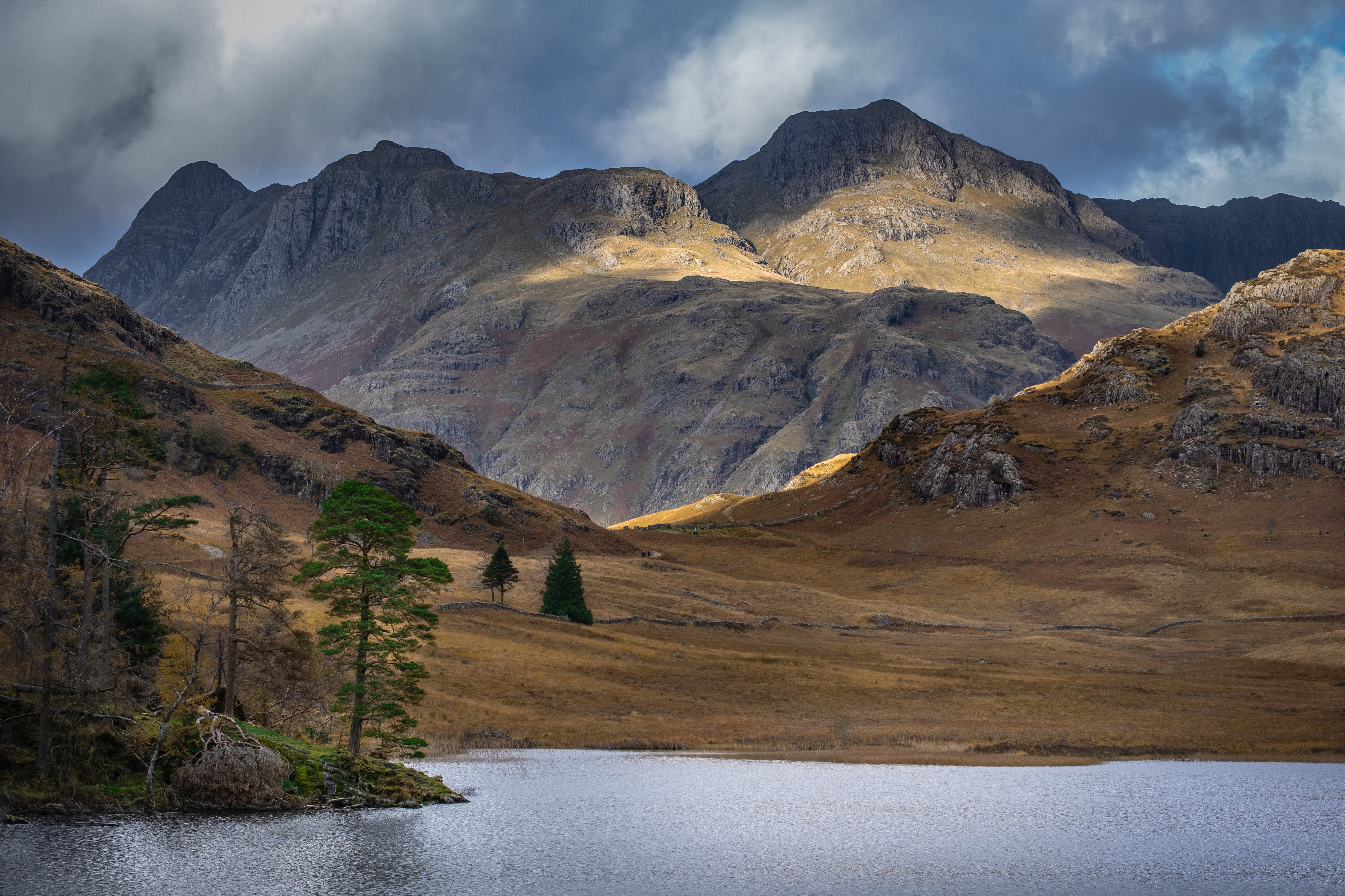
SPECTACULAR – No other word does justice to the classic view from Blea Tarn toward the Langdale Pikes looming up in the distance.
The Langdale Pikes
This walk is short, only 3 km, and presents zero navigational issues. What it lacks in distance it compensates for with a wonderfully scenic experience. In my opinion it is best undertaken on days where the hilltops can be seen.
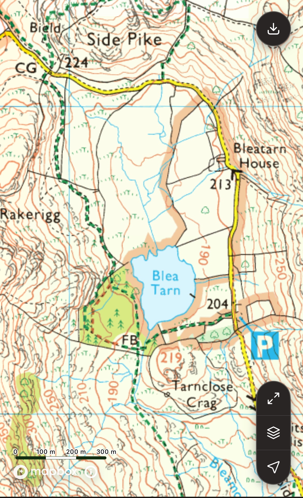
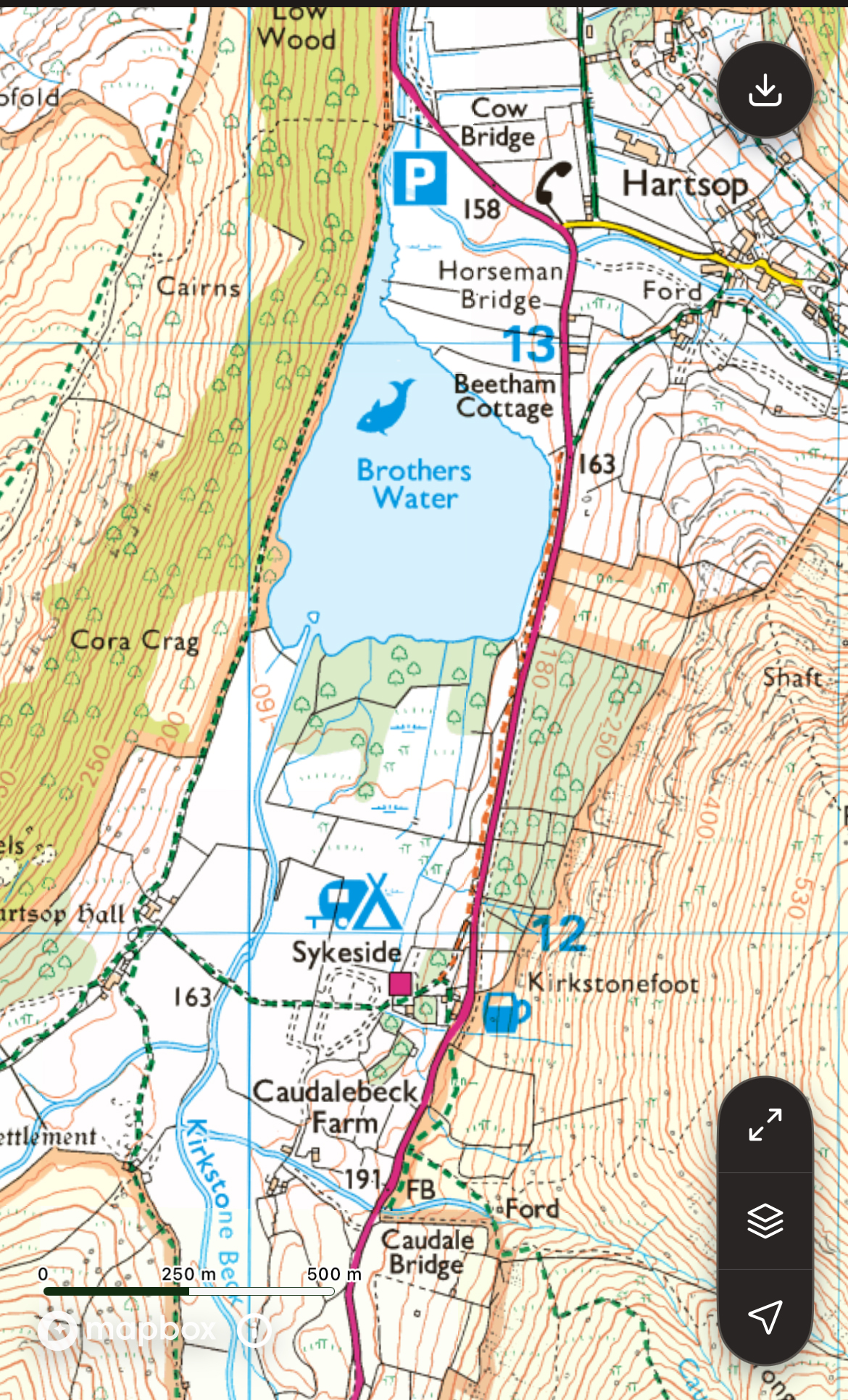
Ordnance Survey Map OL6 The English Lakes (South-Western area) Scale 1:25 000 – 4cm to 1km
Travel by car to Blea Tarn
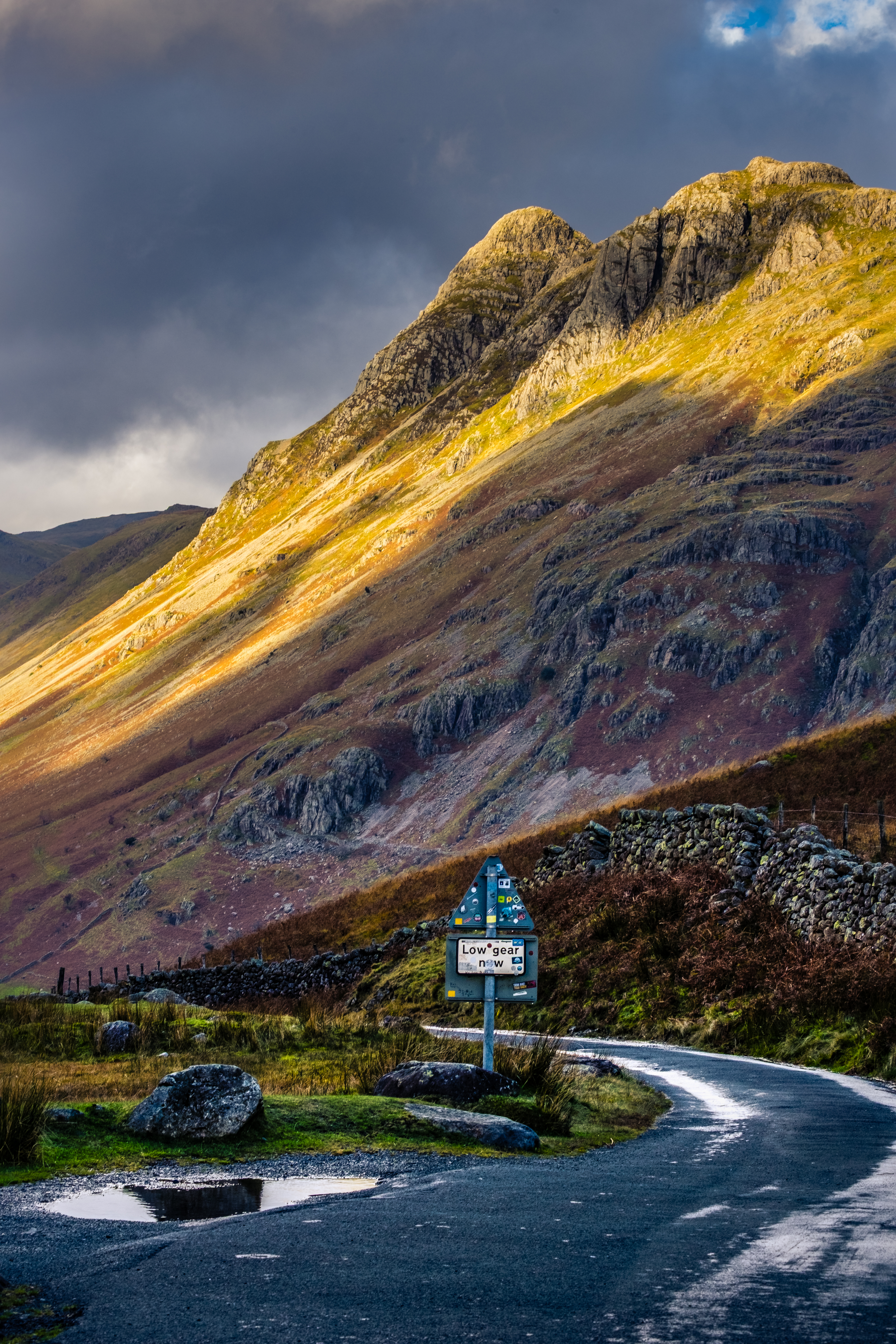
The car park at Blea Tarn entails some difficult driving up narrow twisting roads, often single track with tiny passing places.
From Ambleside travel west on the Langdale road until you reach the end of the main road at Middle Fell Farm and The Old Dungeon Ghyll Hotel (last chance to grab some refreshment). Continue along the narrowing road to Wall End farm where you will realise the next section is a steep, twirling single track (sealed) road soaring up into the sky. Breathe deeply, engage a low gear and proceed with caution.
If you are rubbish at handbrake starts don’t try this … go back to the Old Dungeon Ghyll hotel where there is a sizeable National Trust car park then proceed by Shanks’s pony. Having negotiated the steep snake of a road you will come to a cattle grid where the road flattens out, still narrow but less nerve wracking. After a few minutes you will see the car park on your left.
Note on Car Park – there are no facilities here and for most folk there is no internet connectivity. So trying to pay for parking by phone seldom works and you are advised to pay later in the day when you return to civilisation!
Work around this by joining the National Trust before going, their Trust membership card works in this machine and saves any further anxiety before the walk soothes your soul.
A Tale of 2 Trails and 2 Cattle Grids
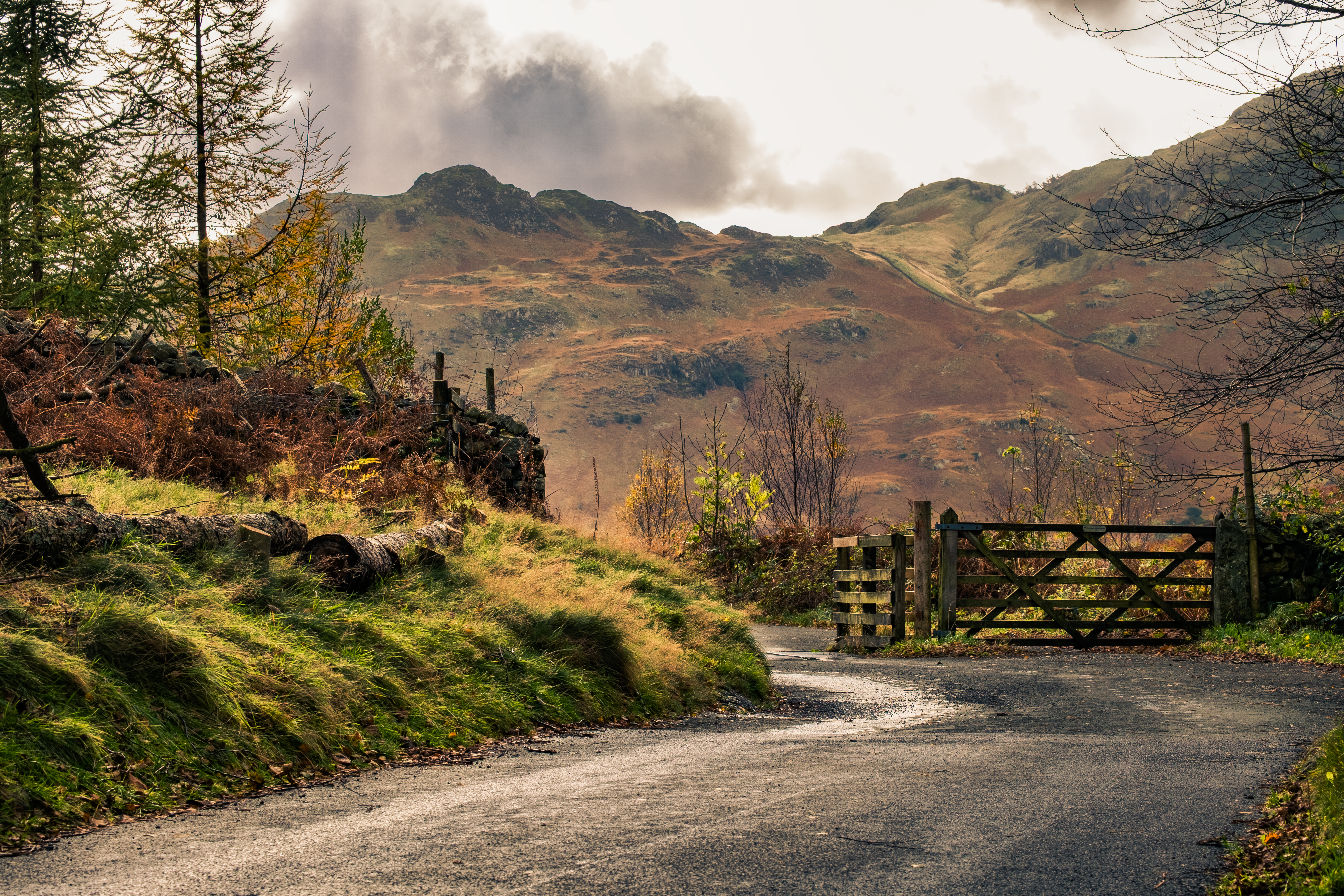
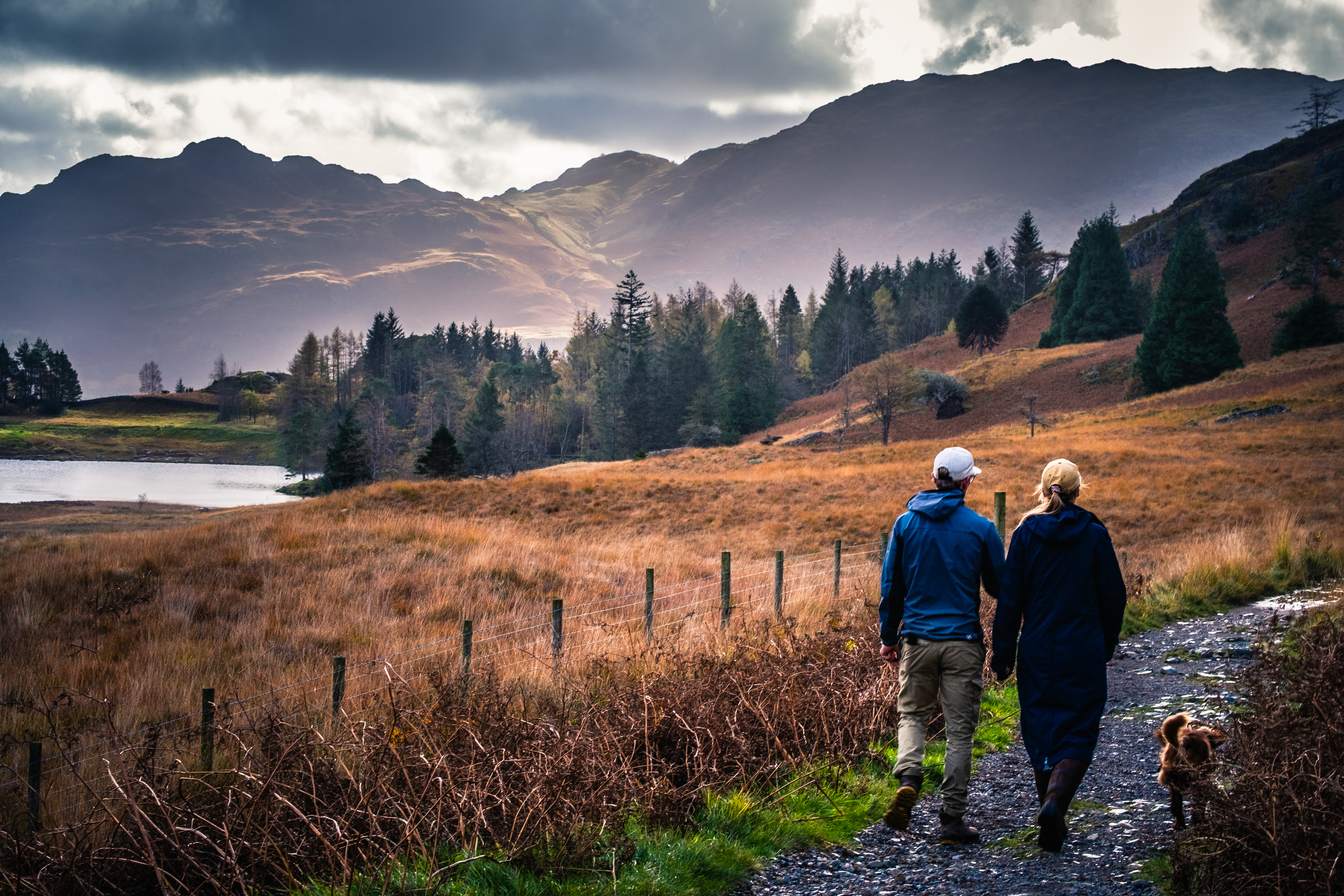
The route starts at the small National Trust car park near the tarn. The outward trail from the car park is along the sealed single track road to the cattle grid atop the steep descent into Great Langdale. The return trail southwards and around the west side of the tarn is a wide unsealed stone and gravel track that meanders around the tarn and back to the car park.
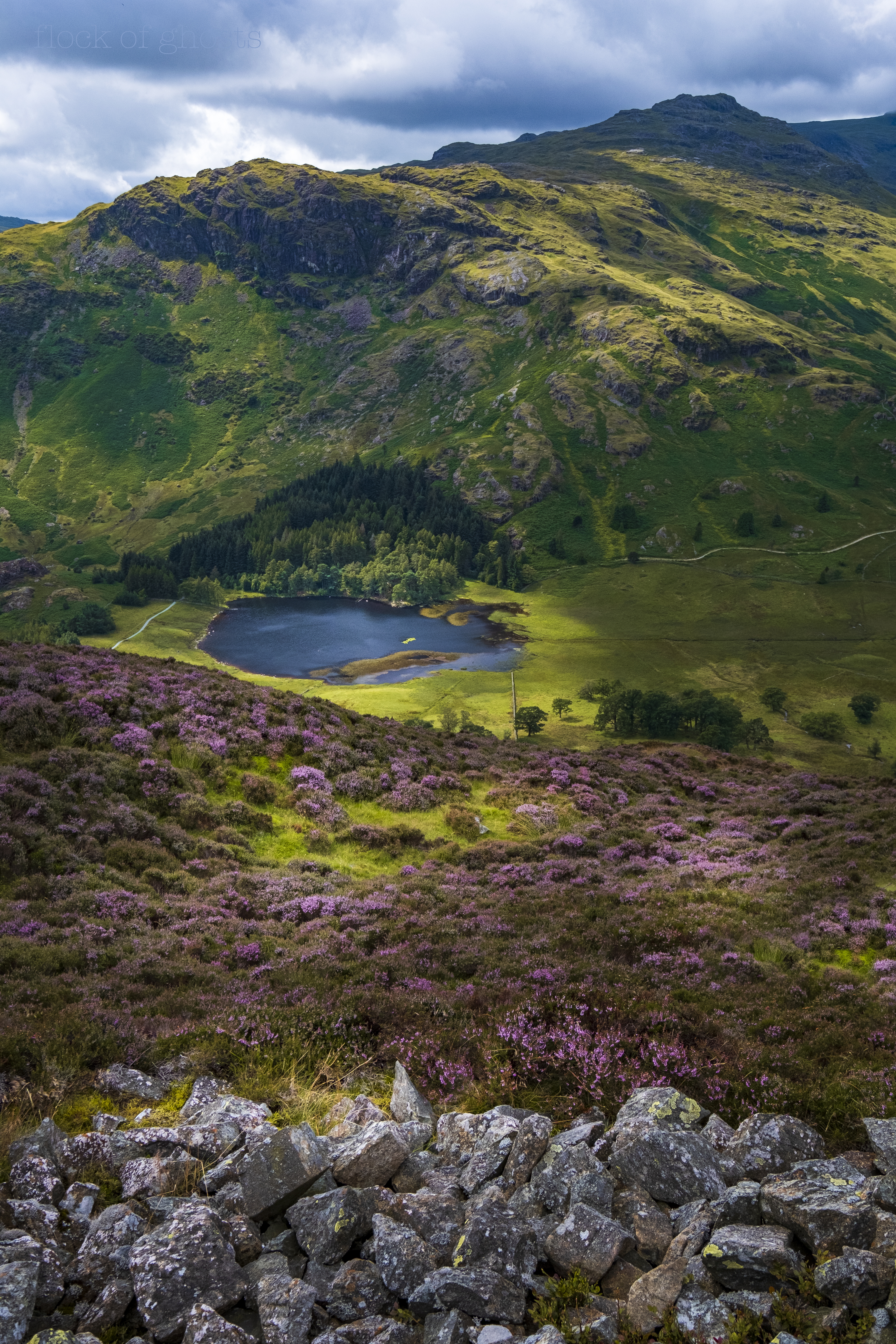
Blea Tarn from Lingmoor Fell with Pike O’Blisco towering above
Off we go … having packed your rucksack and camera (vital today), laced up your boots and locked the car we are ready to go. I love starting walks and this one has instant impact. At the entrance to the car park look down to the tarn then off to your right toward the Langdale Pikes.
Short Preliminary Detour – Before sauntering along the road to your right I would like you to take a very short detour to your left.
A few yards down this road is a cattle grid which you need to cross with care. On the other side is the faintest of tracks to the right and a tiny knoll where you can gaze down into Little Langdale with numerous mounds and hillocks on display. The larger mountains rising behind to the south are the Tilberthwaite Fells at the northern end of the Coniston ridge – Wetherlam, Swirl How and Great Carrs.
Road to the left of the car park
Nearby to the west is a lovely heather clad rocky knob, Tarnclose Crag, with wonderful views over the tarn. I’m not sure if it’s possible to scramble up there nowadays.
View from Tarnclose Crag
Back to the Main Walking Event
Totter back over the cattle grid and enjoy the easy road walking past the car park. Old dry stone walls to the left and open fell slopes to the right. Traffic will be light and always respectful, however my strategy is to step into the grass and stand still as vehicles pass.
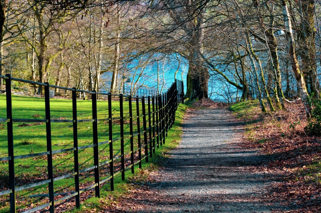
Beginning of your walk
Take your time along this part of the walk. The steep slopes on your right belong to Lingmoor Fell. My favourite time of year in this area is August when the heather is flowering profusely. Ling (meaning heather) absolutely cloaks many hilltops and Lingmoor is a prizewinner.
The tarn is always visible over the wall to your left and and the Langdales will seem huge the closer you get to Bleatarn House. Despite being on a sealed road it feels wonderful to be up high in open country.
Bleatarn House and beck tumbling down from Lingmoor Fell
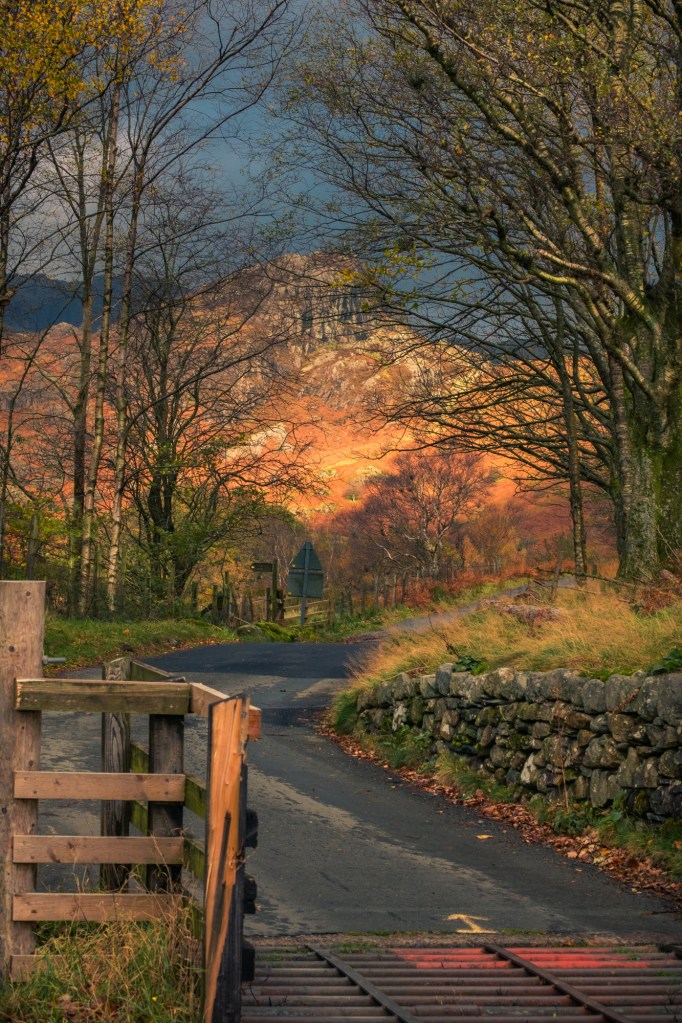
From Bleatarn House your attention will be drawn more toward Side Pike dead ahead. There is a steep path leading up to the col between the rocky summit and Lingmoor Fell, with superlative and classic views from the ridge. I have spent many hours scrambling around the rocky top of Side Pike. For now we are aiming for the cattle grid at the end of the visible road where it plunges down to Great Langdale.
Side Pike
Before you reach the cattlegrid, and turning point on this walk, take some time to look back to the tarn and the Tilberthwaite hills beyond.
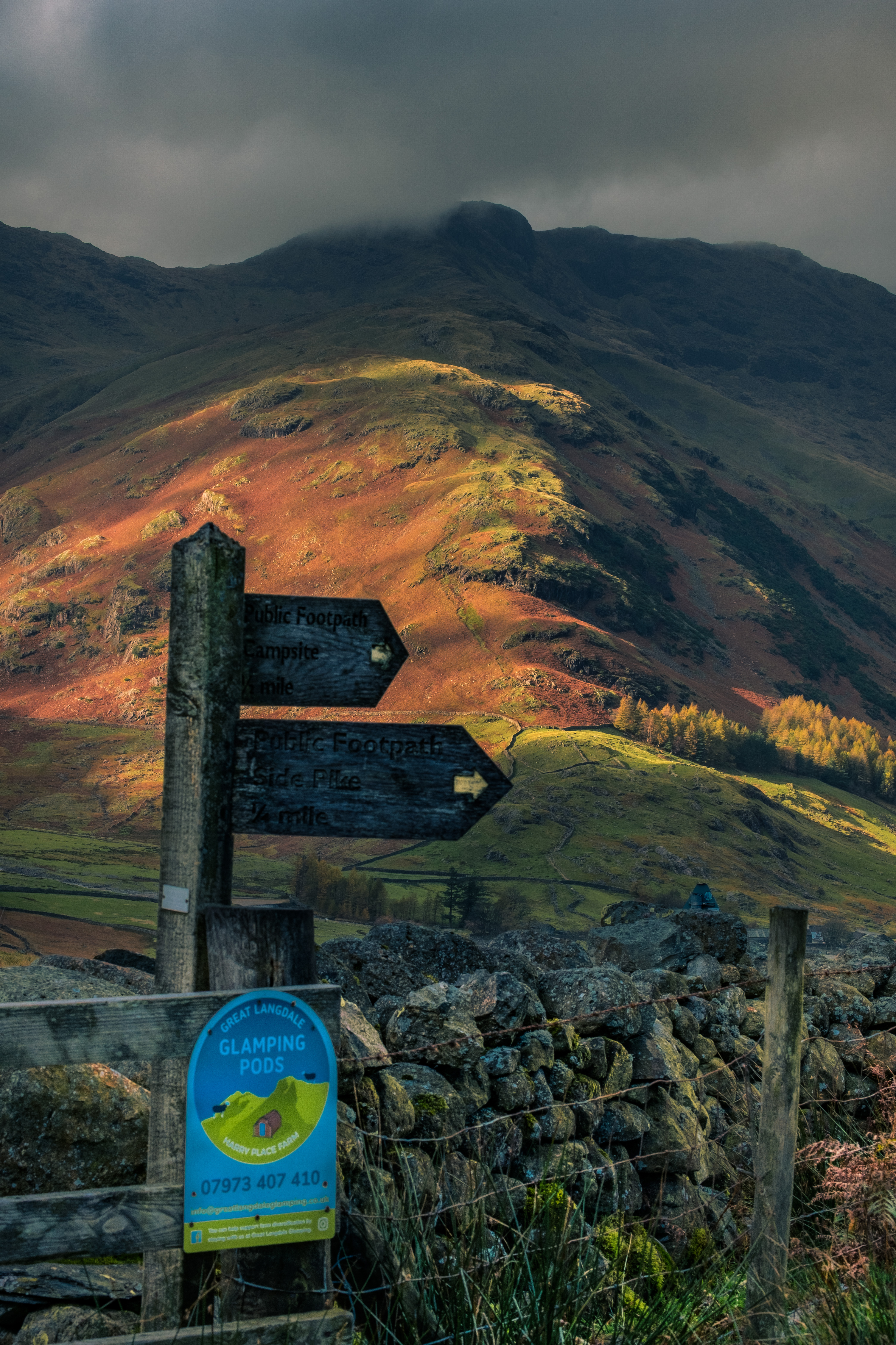
Arrival at the cattle grid is likely to coincide with visitors and walkers deciding which trail to follow at the crossroads. It’s also a perfect picnic spot with views in every direction.
Tremendous view of The Band leading up to the summit of Bowfell in cloudNear vertical drive down to Great Langdale
Our route is to the left through a gate onto the wide stony track heading back toward the tarn. Easy walking all the way with the rocky slopes of Rakerigg and Blake Rigg on your right for company. Your attention is naturally focused on the upcoming tarn.
Another gate opens into the woodland where it’s possible to get to the water’s edge. Recently several large trees have come down cluttering up the wood. Despite the destruction it’s an opportunity to see up close and personal the scale of large tree roots and limbs. I can’t imagine how scary it would have been as ferocious gales were needed to rip these giant trees out of the ground.
West side woodland and outlet stream from the tarn
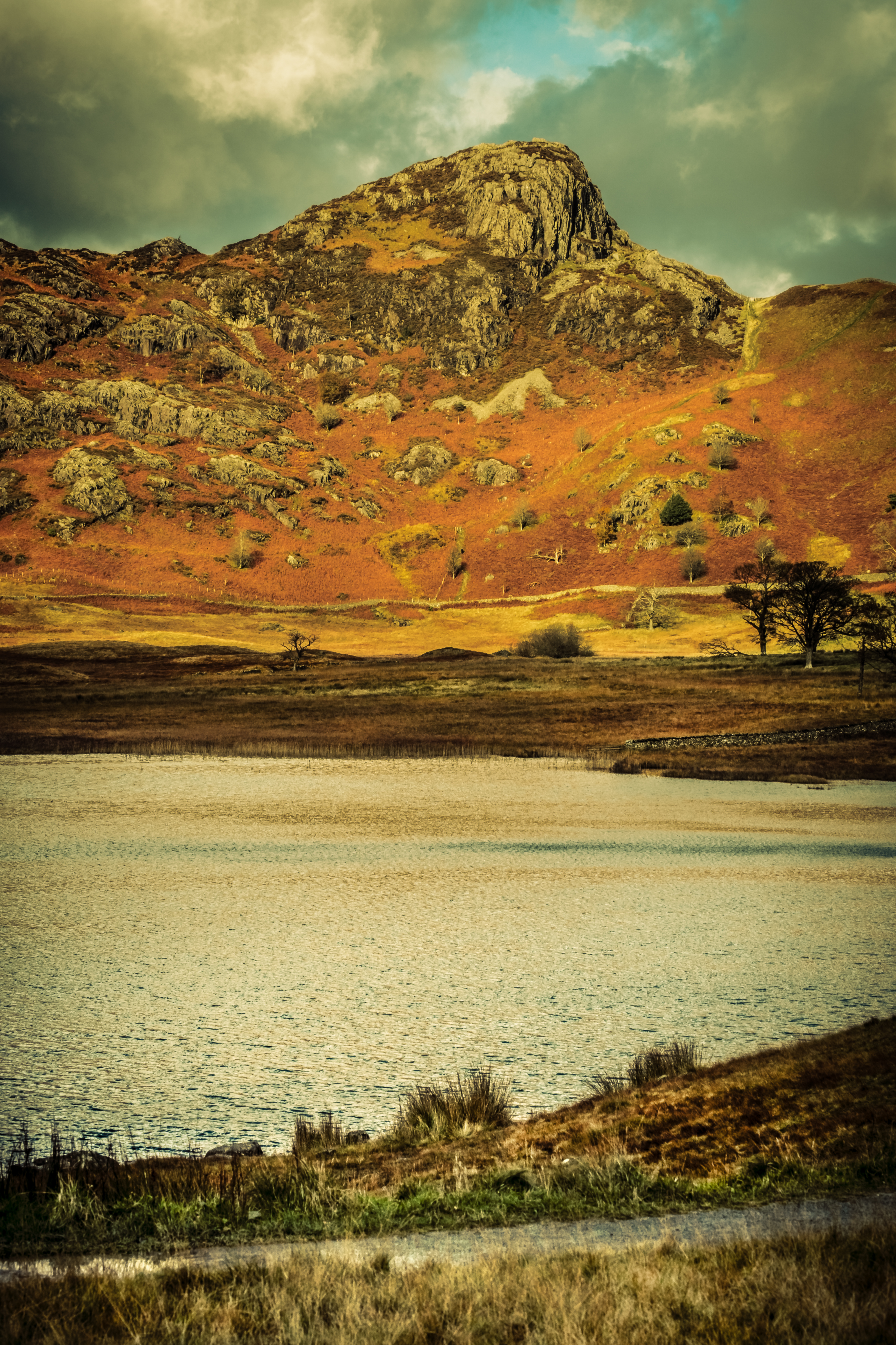
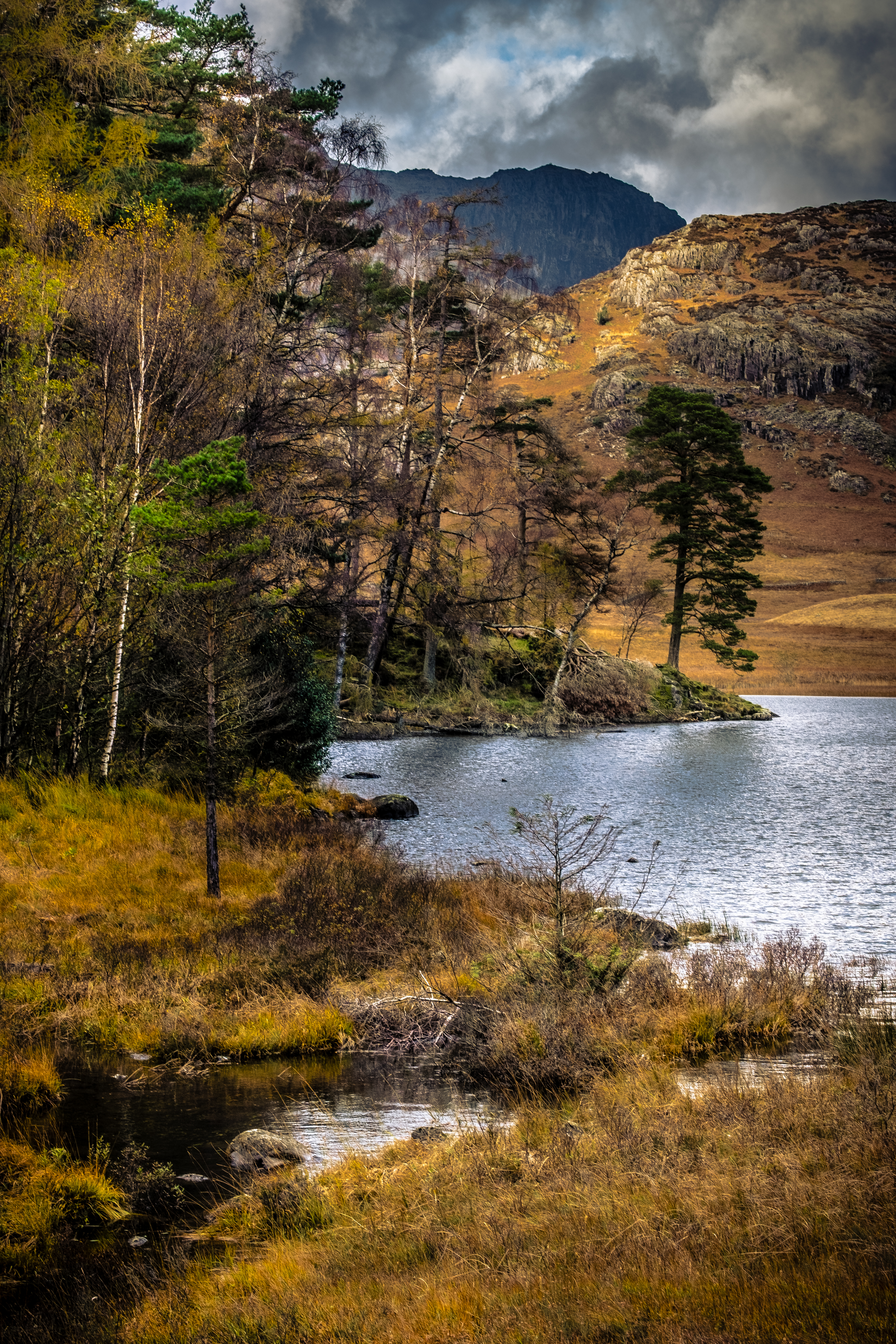
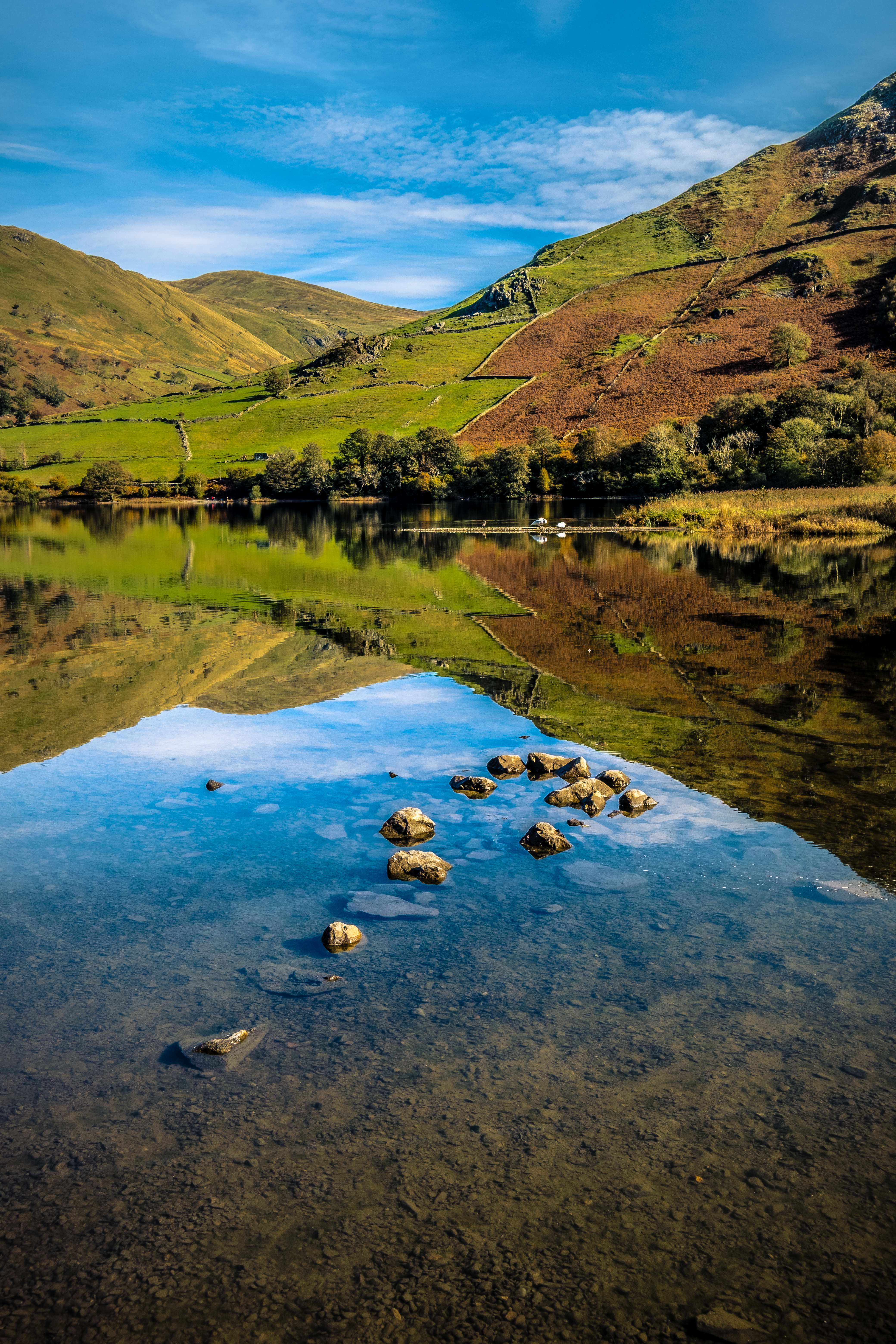
Coming out of the trees at a wooden bridge the track swings around the south side of the tarn with a chance to relax and study the extremely satisfying view over the tarn. It’s worth walking down to the shoreline for a unique perspective on the location.
Blea Tarn – The Borrowed Hills by Scott Preston – Side Pike – Langdale Pikes behind
There are several places to extend the walk along the route, most much more strenuous as they involve scaling high peaks. For me this walk is quite sufficient, in fact it can be difficult on a warm and sunny day to toddle back to the car and leave. Needs must, so it’s goodbye from me. Happy Walking
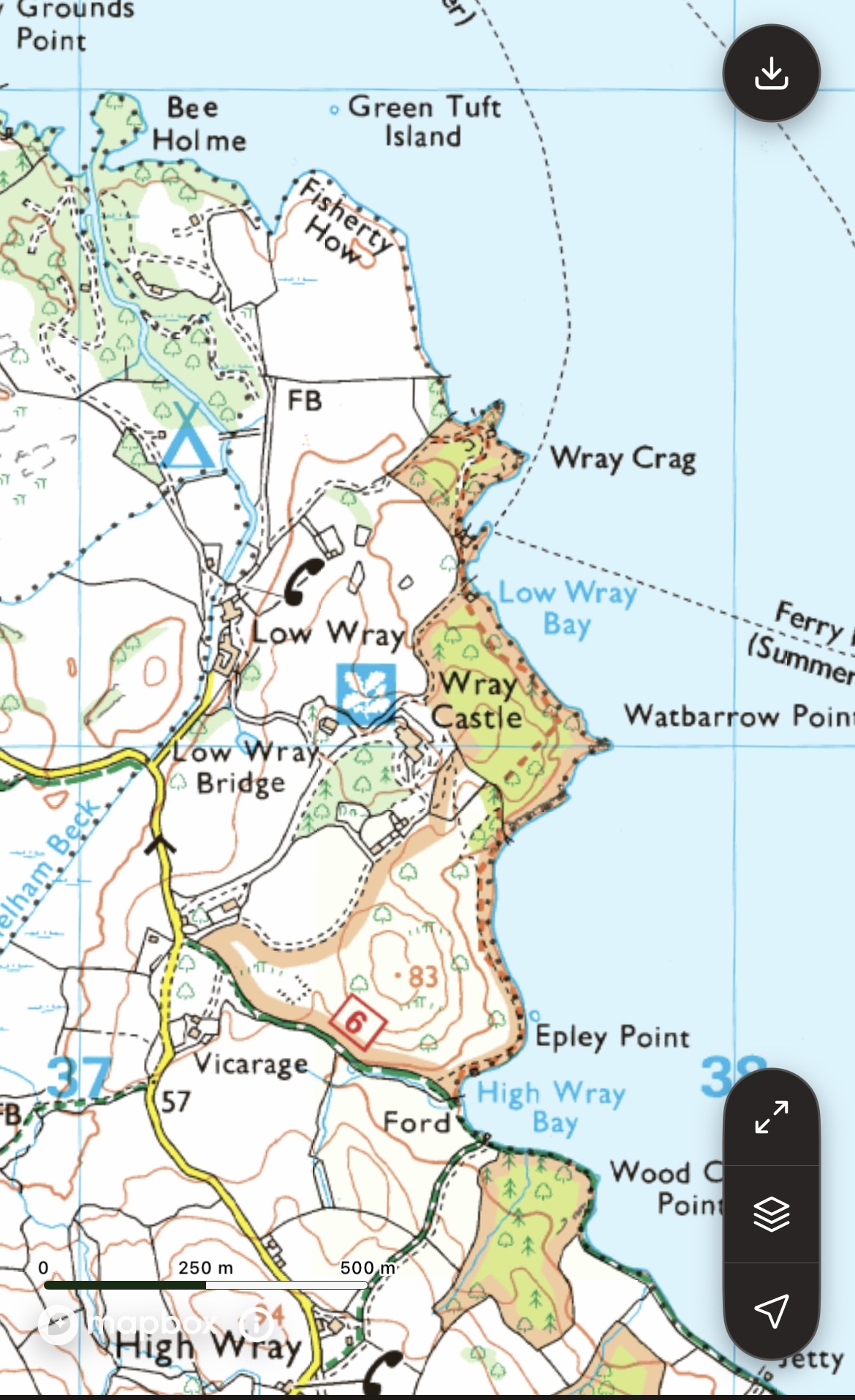
Low Wray Bay is situated between Wray Crag and Watbarrow Point on the Wray Castle Estate, which is managed by the National Trust. The walk that I have chosen is once again an easy stroll (some 4 to 4.5 km) through beautiful countryside, with magnificent views from the western shoreline of Windermere to the surrounding mountains north of Ambleside.
OS Map OL7 THE ENGLISH LAKES south eastern area. 1:25 000 scale and 4cm to 1km
Head to Wray Castle
From Ambleside take the Langdale road, then left to Hawkshead at Brathay and left once again on the Wray road which is quite tricky driving, narrow with limited passing places. From Hawkshead and the south drive toward Near Sawrey and almost immediately take the lane on your left, again a thin lane. Fingers crossed that you don’t meet a Gilbert Brown logging truck! There is also a ferry service in summer, which entails a short walk up to the castle, a very pleasant way to travel to the castle area without all the traffic hassle in the tourist season.
There is a large unsealed car park, Joey’s cafe and toilets. It’s advisable to arrive before 11 am as the car park fills up rapidly nearer to midday.
Wray Castle – Starting Out
Circular walks are fun and flexible.
This short excursion really doesn’t have a boring part and can be extended at many places if you need to stretch your legs.
Lots of advantages to beginning here, most notably a stunning view of the northern reaches of Windermere and the mountains.
Grab a coffee at Joey’s Cafe, wander around the castle perimeter then settle on a bench and gaze beatifically at the views.
Fairfield Horseshoe & Ambleside rainbow
Off we go …
You will no doubt be chomping at the bit to launch off and explore that intoxicating view.
We move off along the exit road for a short distance, passing the house and taking the signposted farm lane dipping downhill on our right.
Right turn here
As you saunter down the lane eyes left to seek out Blelham Tarn in the distance. The fields are still green in autumn and the sun shines as much as it rains, regular as clockwork. So be sure to at least carry a brolly in case speeding showers give you an unexpected drenching.
The seasons in the Lakes
Springtime is delightful, usually warm/mild. However don’t become complacent. Many a glorious sunny day can toss in a curve ball without much warning and suck the blood out of your fingers. Not to mention the hair disaster because you forgot to take a cap!
Autumn is perhaps one of the best times to visit the Lakes as temps are cool but tolerable. Nuff said.
Summer can be deceptively hot with lots of nippy critters jostling for a pint of your blood as you expose juicy arms and legs. In fact horseflies are the worst, you never feel them land, the bite site itches worse than mozzie bites and they can needle you through a t-shirt.
Winter in the Lakes is frustratingly beautiful. I love being out on the trail during winter. Be warned though. It’s cold, it’s wet, it’s windy and a snow shower can ravage your equilibrium in no time flat.
Fully prepared for anything should be your mantra in every season.
Each time I use this lane the huge flock of jackdaws in the area are raucous. On a windy day they love playing in the sky, squabbling and nipping each other as they acrobatically plunge through the void at high speed. Nothing subtle about jackdaws, they will always announce their presence. Also close up they have the most piercing, perhaps menacing, blue eyes.
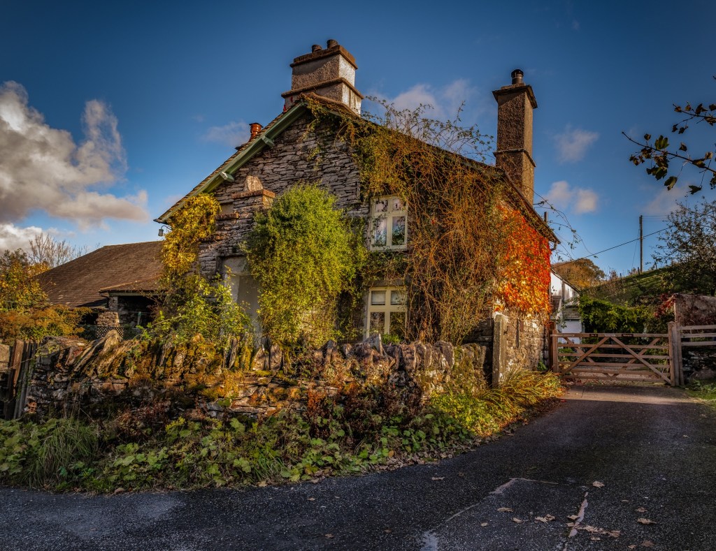
At the bottom of the lane we approach a small cluster of buildings, farm and cottages. This is Low Wray. My preference is to head to the right behind the barn on a grassy swerve. Left drops you onto the sealed campsite road where you should turn right and walk in front of the buildings.
Take a gander inside the barns if the big doors are open, which they often are. One has a mountainous squished pile of fleeces, doesn’t look as if they will be sent for processing. The properties are old and traditional in appearance. Worth noticing the chimney stacks and windows, many haven’t been modernised and these buildings seem to have been left in a time warp.
Back LaneWisteria, Virginia Creeper and vine clad traditional random slate cottageCorner Shop! – Low Wray
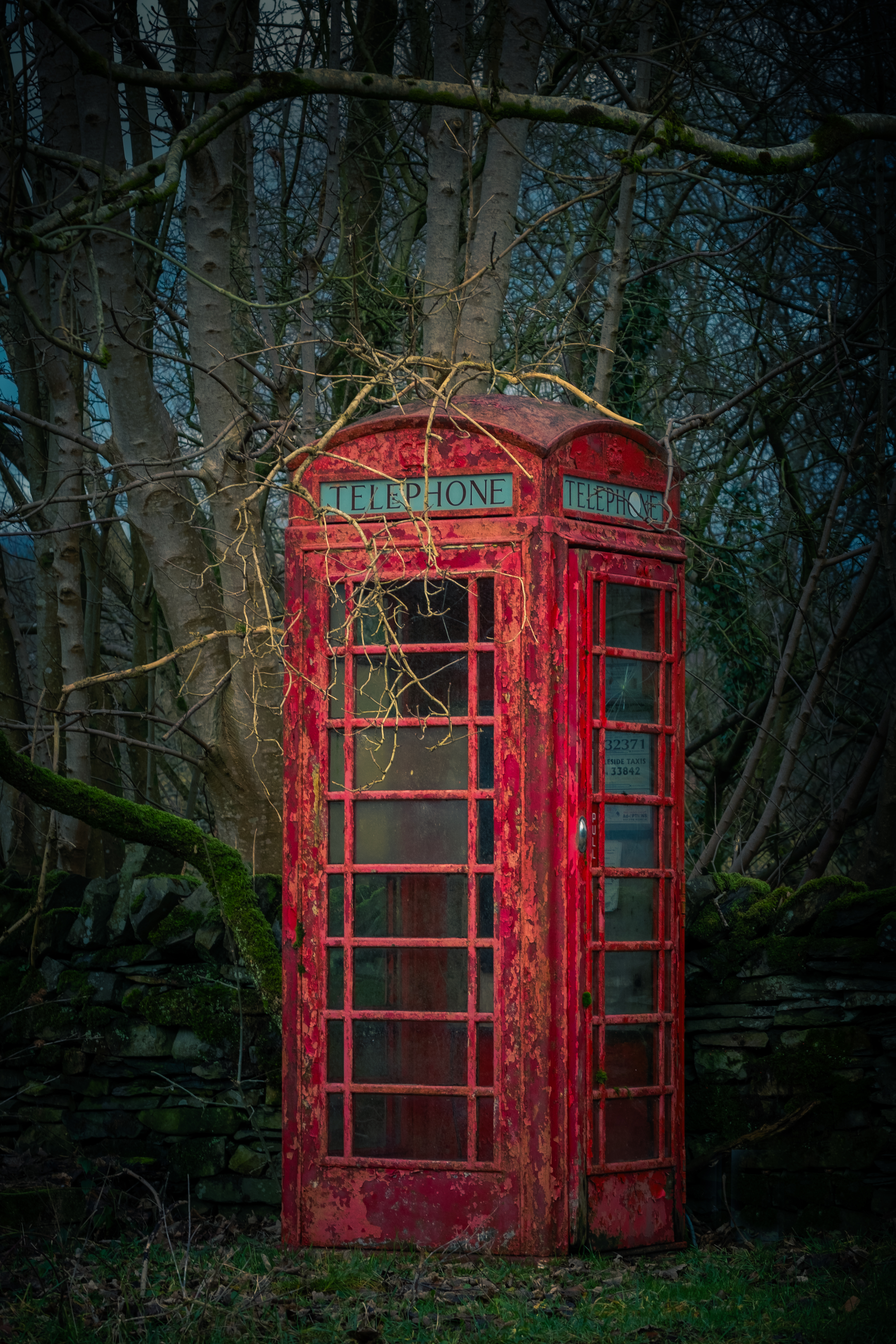
As we emerge from the rear of the buildings you will notice a telephone booth. Doubt that it actually functions as a phone box nowadays, someone had converted it into a miniature library the last time I was there. I love that folk are repurposing these wonderful essentially British icons. I remember many times, as a somewhat wild teenager, running out of money and making reverse charge calls home to ask my Dad to come collect me!
At the phone box you have decisions to make. Take the left or right road at the fork ahead. Both are signposted, and both will get you to the end of the campsite. The right direction being very straightforward. My preference and the one that I am taking you on today is to the left over a cattle grid. In my opinion it is a more interesting walk, slightly longer and a bit twisty with tricky fingerpost choices in places. As long as you ignore all paths to Ambleside and align yourself to follow Wray Castle directions you will survive intact … maybe … probably!
Sign Post confusion … Because the campsite is a sprawling affair with numerous sections and tracks leading every which way it is a good idea to read the signposts carefully. Invariably you should be heading toward the castle. For folk staying on the site, I understand the need for the plethora of signposts, but as a walking visitor it can be confusing.
Having an OS map is essential. I find subbing up for the digital version very helpful when on unknown terrain. Particularly useful is the locator, which will drop a red triangular pointer to indicate your current position. I love paper maps too, map reading consumed me for hours whilst I was planning long distance routes. So please, don’t attempt any of my walks without a map.
Onward choosing the LEFT road
At this juncture is a very peculiar packhorse bridge over Blelham Beck, well worth an inspection. It doesn’t look like a packhorse bridge at first sight, overgrown with grass and wildness, plus an iron gate on top! 20 paces takes you to the top and a chance to stand on history, the don’t make ’em like this any longer.
The road is straightforward with fields on either side. A coppice can be seen ahead which has lovely colour in autumn. Pass the coppice on your left, ignore the track and building to the right, then ponder on the signpost. Our way marker says Wray Castle 1.25 miles, Ferry launch 1 mile and Shop/Reception Pizza/Bike hire. Pizza!! Imagine that, having a slice of Hawaiian pizza on a Lake District walk.
Head toward the stands of silver birch where the road swoops around to the right and you enter the campsite proper with numbered pitches. As you will see shortly this is a rare campsite with Windermere lake access. Pitches are well separated and there is a lovely sense of being in the wild.
Follow the track past a toilet block, ignoring (for now) the long wooden bridge walkway and plod on a little further until you come to a bay at Bee Holme. This is such an idyllic place to relax for a few minutes before reversing to the bridge and crossing over. Once you arrive at the sealed road turn left passing another toilet block before swinging to the right away from the camping area
Bee Holme Bay
Pass through 2 iron gates onto a section of duckboards by the side of the lake and onto the rounded nose of Fisherty How. The views to Ambleside and westward toward the Langdale Pikes is exceptional. From here until you reach the woods at Wray Crag are loads of waterfowl, Canada Geese in particular. If the lake isn’t high you can walk along the gravelly shoreline and sit on lovely rounded boulders to take it all in. This upcoming woodland part of the walk is a place to linger.
More iron gates end this section and you enter the woods of Wray Crag. Take a short detour out to your left with more stunning views up the lake. Many trees here are superb specimens and in autumn the ground is a thick leafy mattress.
Low Wray Bay at last …
You are now in paradise 😇
This part of the walk is utterly delightful. Throughout, until we exit the wood to walk back up to the castle, you will be enthralled under a tree canopy of towering beech and oak. This is how woods should be, fallen branches are left to decompose creating habitat for woodland creatures, fungi, ferns, lichens and moss. It feels natural and perfect. I visit this area often.
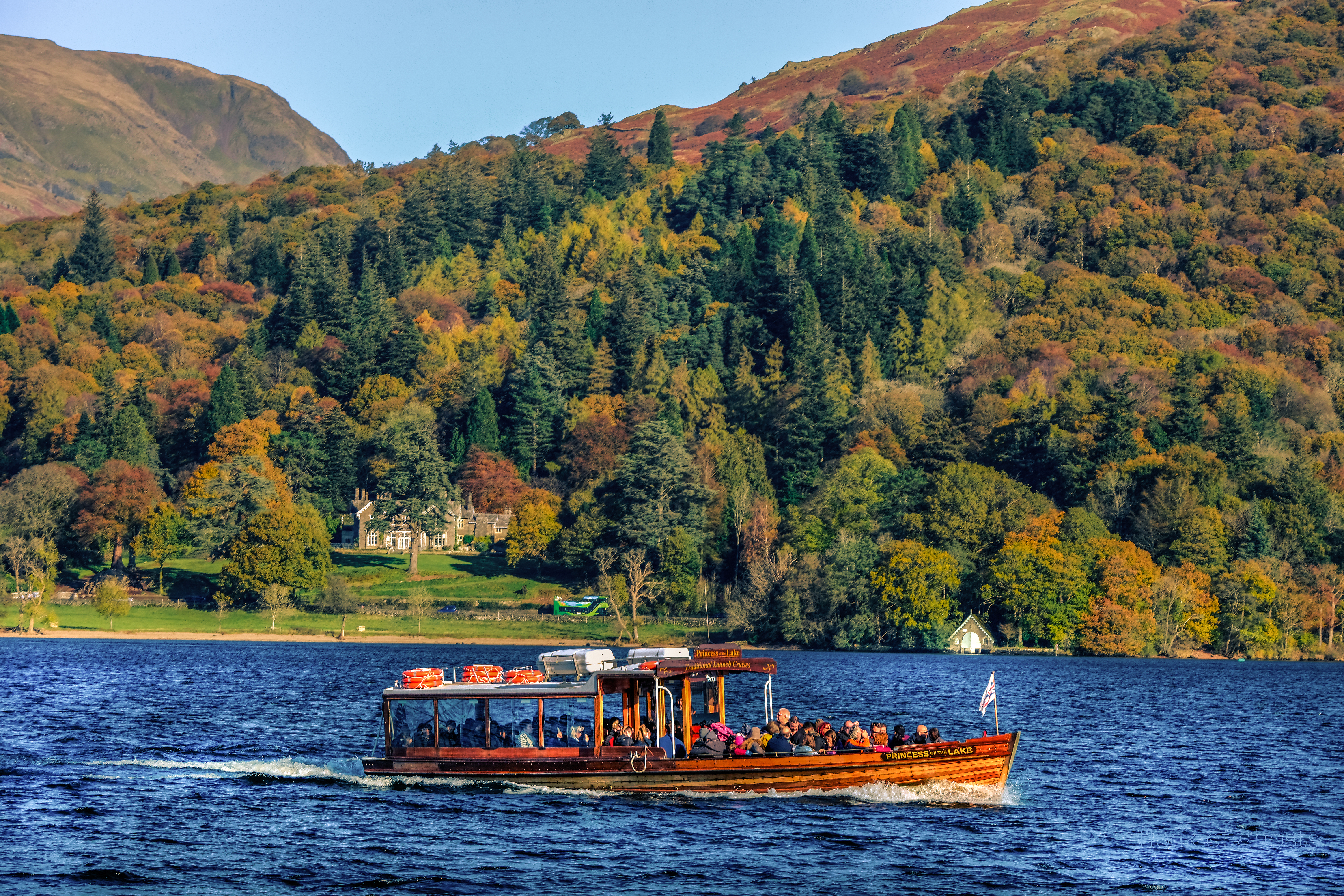
Wray Crag protrudes into the lake, with rocky perches and tiny inlets. Inevitably you will see various boats moving up and down the lake, some of the sailing boats and small motorised craft may pass close to the shore. The larger passenger ferries stay toward the middle unless heading to a landing jetty.
Princess of the Lake
Every other tree seems to create a frame ripe for a photograph. At the water’s edge small waves lap and birds seem to flit along with you through the tree tops, singing and scolding as they see fit.
For you twitcher types who take magnificent bird shots I am in awe. Swans are the only birds I have successfully captured on camera, cos they move slowly. Anyone getting pin sharp photos of a kingfisher in action commands ultimate respect.
There is now a short sinuous path before arriving at the landing jetty.
Lots of information boards and helpful waymarkers here. The boat houses are impressive and well worth a look.
At this point you can take a shortcut back up to the car park beside an iron fence.
My preference is to continue ahead and enjoy the woodland which has an endless stream of beautiful scenes … it could be a dream.
In short order we reach an open area by a tiny bay with Watbarrow Point obvious. Make the short scramble up the rocks and spend a little while on this perch.
The views north to Waterhead and south to the islands in the middle of the lake at Bowness on Windermere are stunning. This spot helps to put the scale of Windermere into perspective. There is one heck of a lot of water.
Watbarrow Point
Carefully scrambling down from the rocks we head off once more along the obvious path westward. Up a slope you will notice the exit as we reach another metal gate that leads us out of the wood into a large open field.
Final few trees before we exit the woodland
Looking to the left we will see a popular grassy area beside the lake. Invariably there will be family groups having picnics and children playing.
For us, our attention is up to the right where a grassy path ahead leads to the wide gravelled trail back to the castle.
Plodding up the hill gives time to reflect and realise what a marvellous 4 km walk we have just completed.
Wray Castle
If time permits and the light is right at the of the day walk around to the north side of the castle and sit quietly. Breath in the view and store your memories.
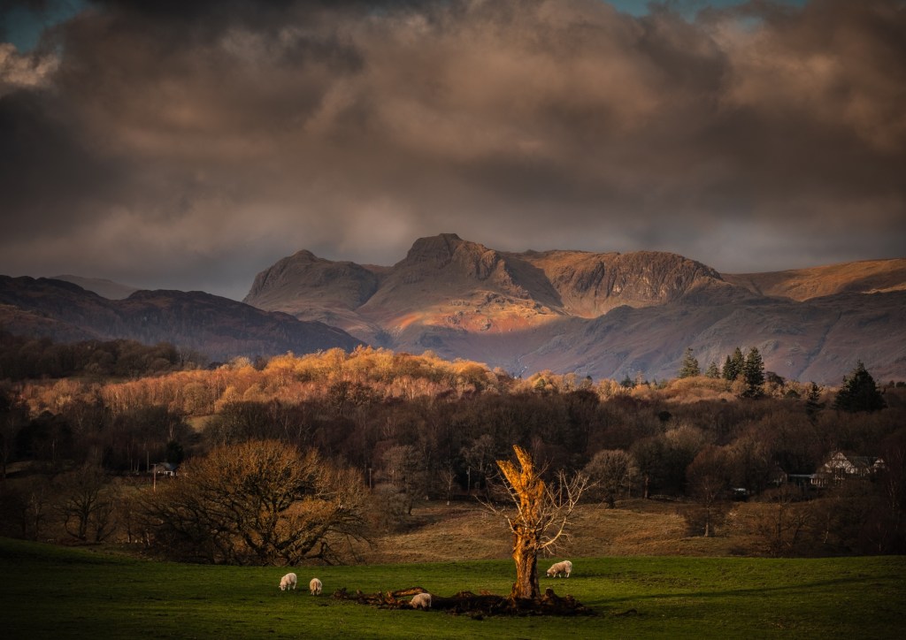
Age waits for nobody. My creaky joints need cajoling with painkillers and all the anti inflammatory foods I can wolf down. Consequently I am restricted to lower level trundles these days and this walk around Brotherswater is one of my favourites at any time of year.
Maybe 4km to 5km this walk offers superb views in all directions and immersion in the proximity of nature. Paths and tracks are easy and waymarked.
So put on your specs, relax in a chair and enjoy the journey as I guide you along step by step. Photos are taken from every season and my thoughts articulated without much editing! Then, should you feel adventurous, go out and give it a twirl, you will have zero regrets.
In the Beginning
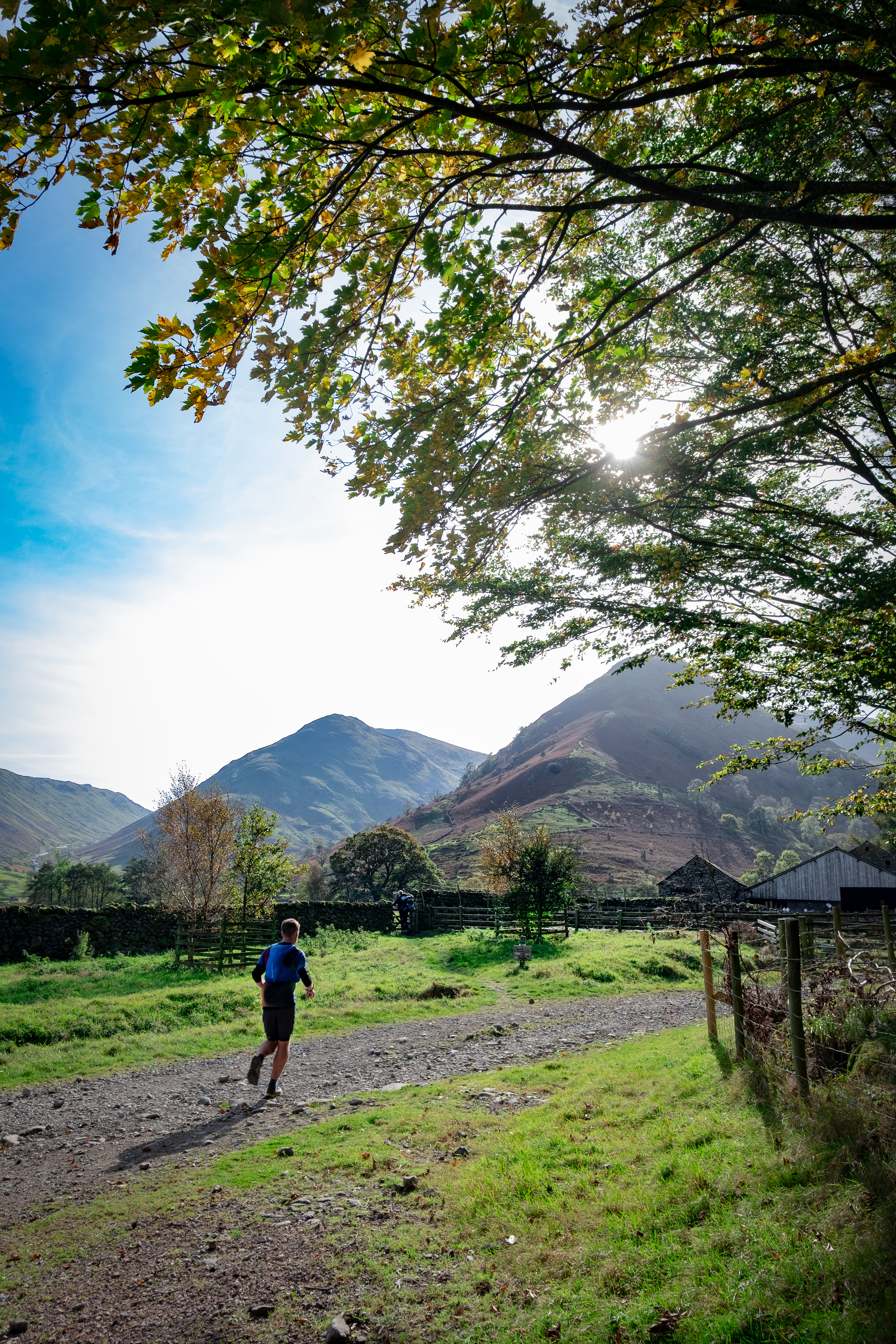
Drive to any small lay-by just south of the Brotherswater Inn at Sykeside. Even in the height of holiday season you will often find a parking space. My favourite space is at Caudale Bridge where there is a gate leading directly onto the bridge, where you can take stock whilst looking at the rushing beck hurtling down the fell and under your feet to decide if you have remembered to put your sarnies in the backpack. If you are like me you may have forgotten to change into your walking boots! Go back pdq and fix things
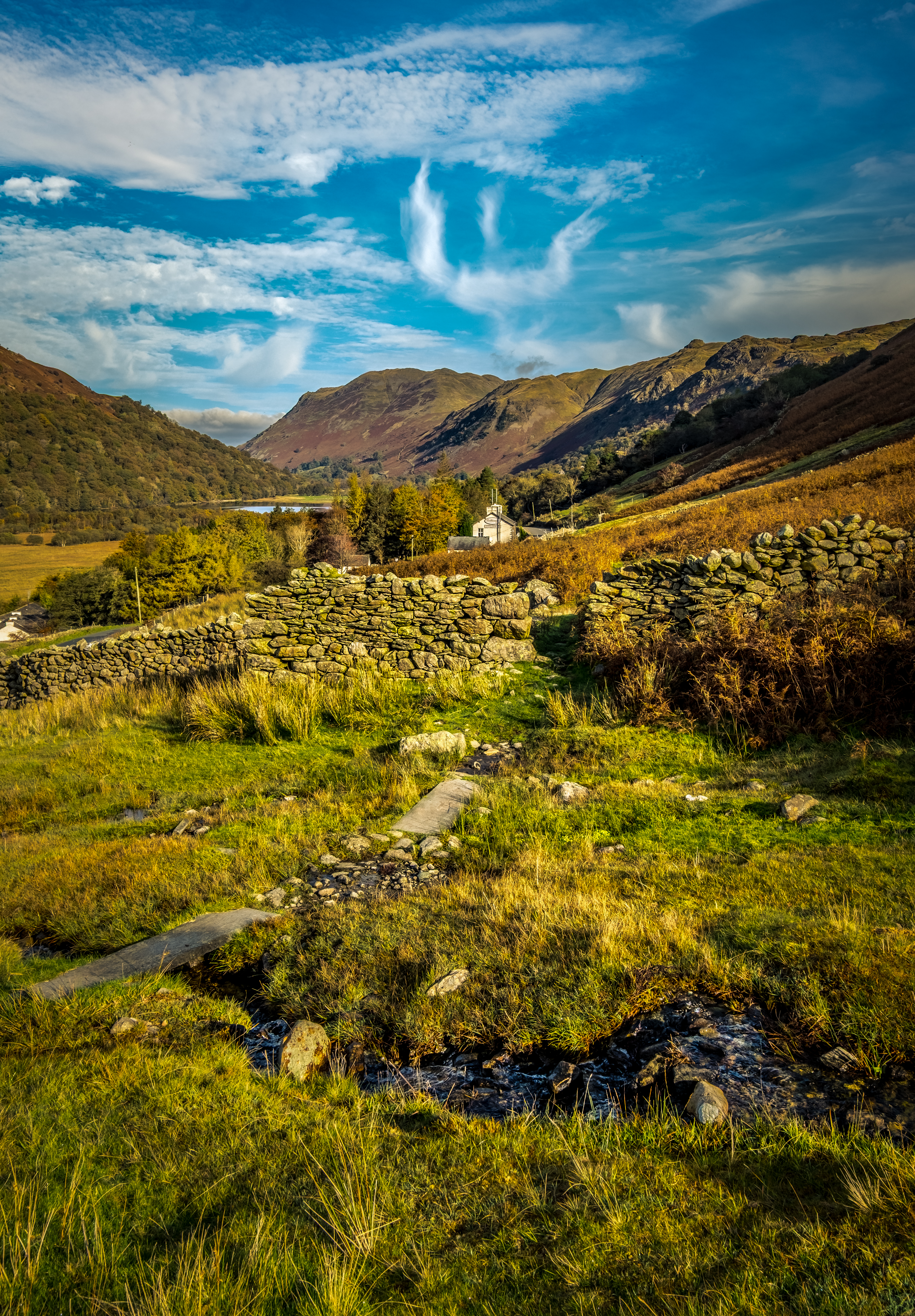
Suitably pacified you can head off immediately into the rough pasture over the bridge, following what amounts to a sheep track. Angle gently up the slope until you come to a flattish area where there has been some kind of building in times of yore. Turn to the west and sigh because this view up Dovedale to Dove Crag and the bracken coated shoulder of High Hartsop Dodd is worth every penny of the entrance fee
High Hartsop Dodd – Dove Crag – Hart Crag from the Kirkstone Pass road
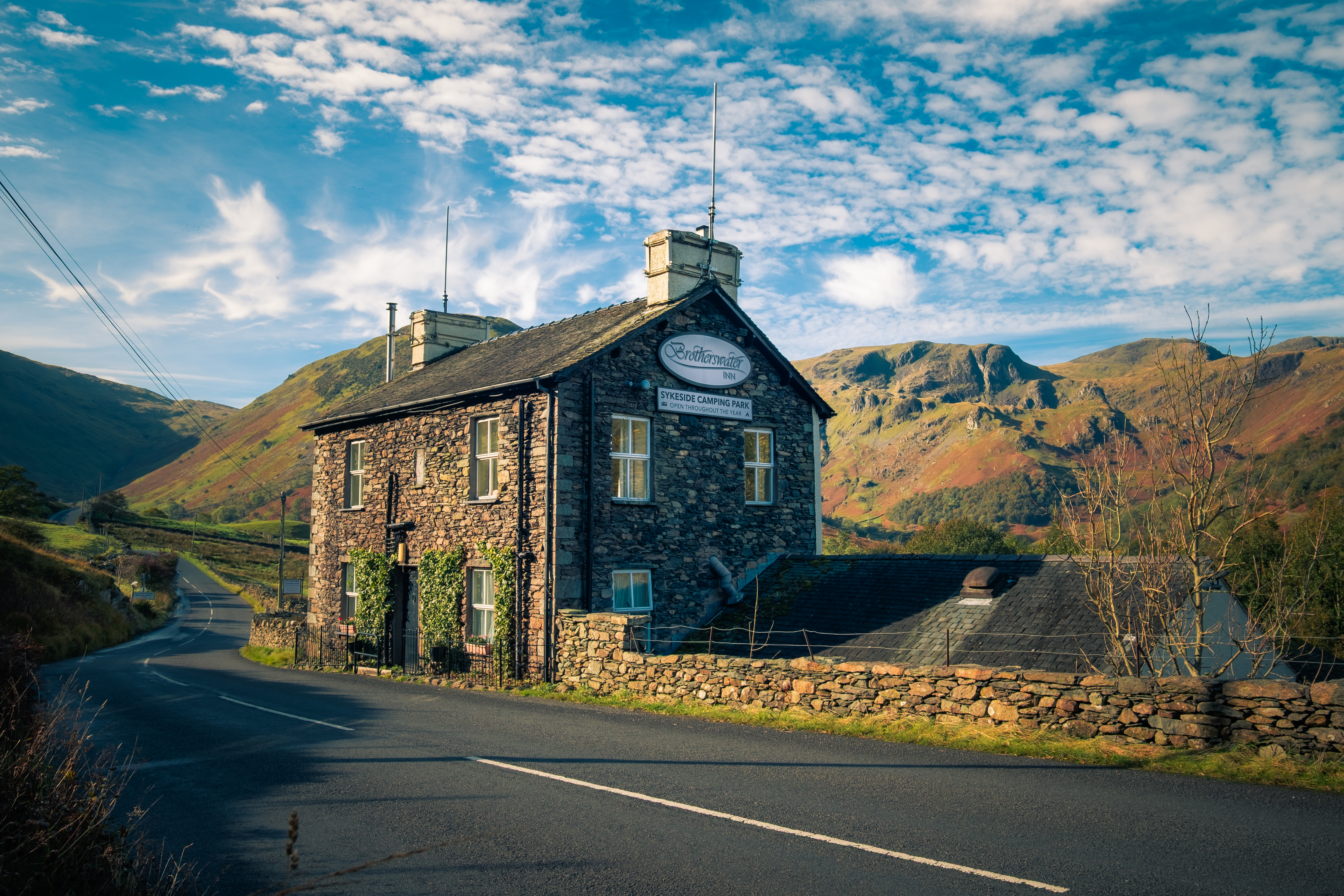
After soaking in the view turn your attention northwards where the thin path crosses a stream on a large flagstone, pausing for a moment to marvel at the pristine clean water tumbling over washed rocks and pebbles. Then walk through the gap in the wall. Once there you can admire the prospect with the Inn, Brotherswater and Place Fell taking centre stage. The lake looks more like a postage stamp from here yet within 30 minutes you could be on the shoreline.
Brotherswater Inn
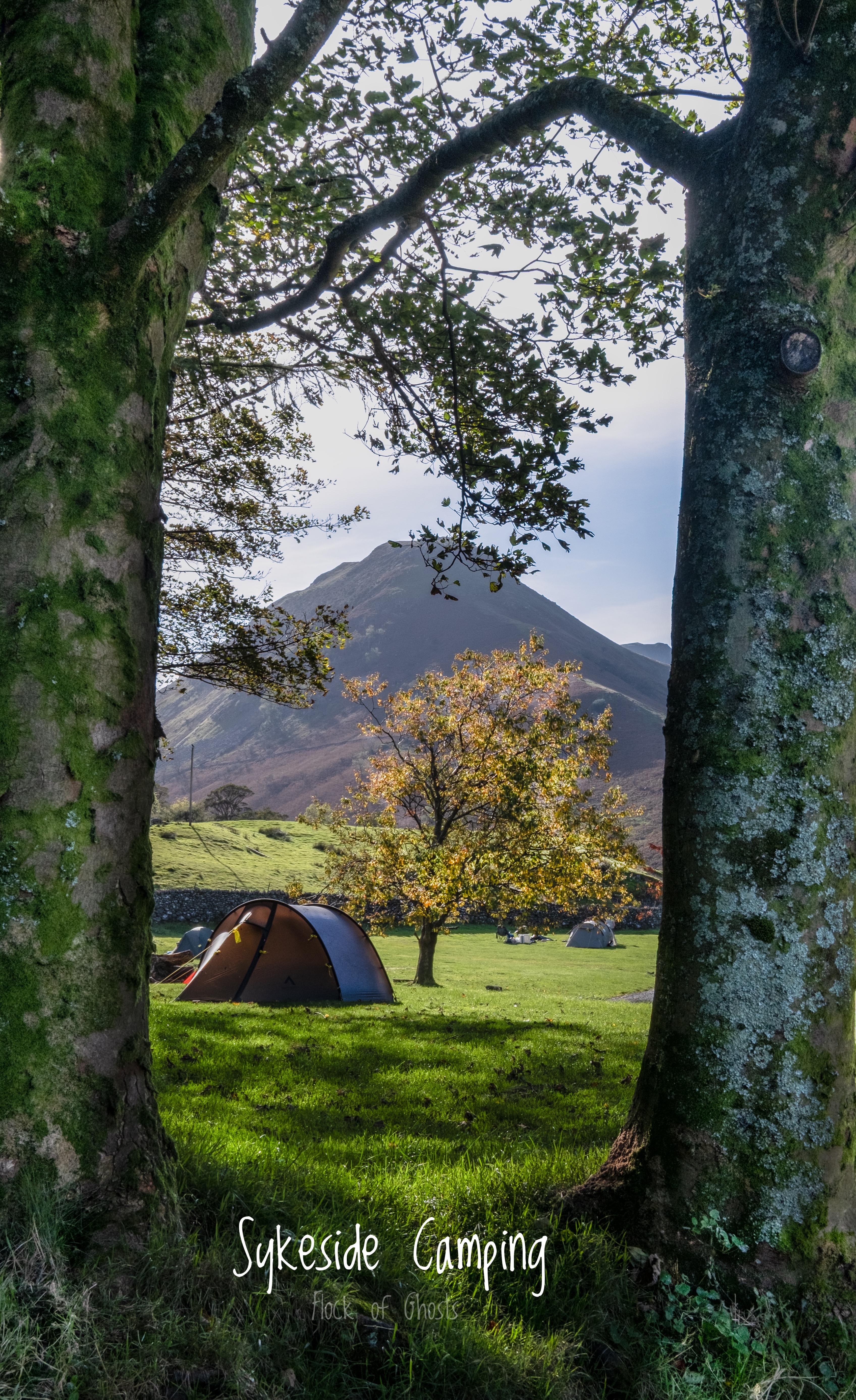
As you descend the final field of the fell you will notice the Inn at the end of the path. This Inn holds myriad memories for me over the past 50 years. Sykeside camp site is just nearby and a place that I often used as a base camp many years ago. For such a mountainous area the site is unusually flat and well tended.
The door in the middle of the building used to be the main entrance (now behind the building with a large parking area). Going through that door for a pint after a long day on the fells was exhilarating. Almost always rammed full of climbers and walkers, 2 sheets to the wind and singing on top note. Swing Low Sweet Chariots got the walls vibrating. Worth noting that the air inside was dense with cigarette smoke and condensation trickled down the walls from the heat of folk packed together. Actually it may well have been spilled beer as it was traditional to douse each other with overfull pints in passing.
Nowadays the Inn does a good range of hearty meals, breakfast, lunch and dinner, with lots of outdoor seating and tables. I remember taking my children (4 of them) for Sunday lunch. Hard to believe that my youngest gained his PhD a few years ago and is an acclaimed author! Memories come flooding back every time I pass by the pub.
Onward …
Passing the pub (for now) follow the wall a few hundred yards to the first left turn down to Sykeside Campsite where the next section of path appears
Lots of paths like this have sprouted up over recent times to encourage walkers off the roads. It has to be said that traffic coming down from Kirkstone Pass drive at ridiculous speeds making it perilous to walk in the verges. This path travels alongside of the road in the edge of the fields and is fenced off to prevent livestock getting tangled up with delicate walkers.
The path is narrow, only wide enough for walkers to travel in single file, needing to politely step aside for others if necessary. Now is a good point in my verbiage to explain protocol and good etiquette for walkers.
Walking Protocol
Once you start walking be prepared to say Morning, Hello, Hi, Afternoon and smile at every person you meet. Unlike city streets people actually acknowledge each other on these trails. It isn’t uncommon to strike up a conversation with complete strangers, just because that is what you do.
If you see a grey haired old guy bumbling along with a stick say hello. It could be me!
Most folk are very polite and respect the area, they would be devastated to see you littering or failing to bag that dog muck. It feels like a homogeneous glob of humanity who are simply enjoying the outdoors without taking anything away except photos and memories
Back to the business at hand …
Progress along this section of the walk is pointedly different than the open fellside above the Inn. The path gently weaves around trees and small outcrops of rock, mostly dry underfoot with a few short muddy stretches. Don’t rush this part because the views behind toward Dove Crag are worth a few stops. You will also notice Hartsop Hall appearing across the valley.
The views ahead with glimpses of Place Fell are enticing. Compelling forward momentum here because Brotherswater is close.
The path swings up to the road then immediately dives down to the water, and this is where the real delight begins. Brotherswater is a shallow lake being fed to the south from swift mountain streams and exiting more sedately northwards to feed into Ullswater. The lake isn’t very big however it is hemmed in on the sides by some magnificent hanging woodland and the slopes of Hartsop above How and Hartsop Dodd. These relics of days before much of the Lake District was fell-cleared by the monasteries to provide rough grazing land for sheep are precious. Once we start to head home from Cow Bridge these woods will envelope you and you should hear lots of birdsong. If you are very lucky and have sharp eyes, you may find red squirrels scampering up and down the trees.
Brotherswater
So here it is, your first chance to stand beside the water. Albeit a bit muddy if the lake is high, it still needs a reflective stop to take it in. By now you may be tempted to break out the sarnies, my advice is wait a little while. There are 2 wonderful food stops coming up.
Shuffle a bit closer to the blue patch and breathe in deeply.
Pop your eyes back in the sockets and we’re off again. The water is always close by and the views irrepressible, so pause often, we never hurry on my walks.
There is a very natural feel to this next short section. The path wanders over tree roots and dips down to the water in places, nothing seems out of place here despite the road being a few yards above and to the right. Once your mind is engaged in observation of the surroundings the road noise doesn’t factor, and there is a sense of unification as your soul blends with this exquisite place.
Numerous waterfowl live on the lake, when you see a diving duck notice where it dips down and see if you can spot where it re-emerges. Often quite a distance away
On my most recent walk there I noticed some weird orange buoys drifting along near the far shore. It seemed odd because there was little wind that day. All was revealed on the other side when I met 4 ladies walking down the trail toward me wearing massive sack like overcoats. They had been wild swimming and towed their gear in 2 orange floats as they progressed upstream. Can’t say that I felt tempted to dip my toes in the water, let alone swim. I had a brief chat with them and they reckoned the water was warm and believed everyone should try it …erm … nah
Lunch and Contemplation
As we come out of the wooded area a longish beach appears. Stepping onto the beach it is mandatory to pick up a pebble and throw it in the water, see if you can get a photo of the splash. I have tried this many times over the years and often fail.
This is my fave spot to have a sit down. The massive roots on the tree to the left of the photo are smooth and a perfect height. Also a very good spot to contemplate the view, and consider what a magnificent place the Lake District is. National Parks in many countries around the world have an entrance fee. Because ours is a lived in area it is open to anyone who can get here and considering how vast the number of visitors are each day, it remains, in many areas, as it always has been before the Victorians became adventurous and adopted charabanc coach trips, eventually charabanc fever escalated becoming overstuffed vehicles that arrived in the Lakes. I heard that the visitors had to disembark at the bottom of Kirkstone and walk to the top. The charabanc had to reverse up the hill! For me it is home and has been for much of my adult life. It is a privilege to live and work here and I never take it for granted.
Packing away our lunch it’s time for a dose of reality. Back beside the road for a short distance. Out of the last gate there is a sealed footpath that leads past the turning for Hartsop hamlet and down to Cow Bridge.
Another nostalgia hit at Cow Bridge. Father and his friend Pete rebuilt this wall that runs between the car park and road. I remember him saying how difficult it was because there were nothing but round boulders. I have to say it’s a remarkably neat and tidy dry stone wall that should last for many years to come. Well done Pops!
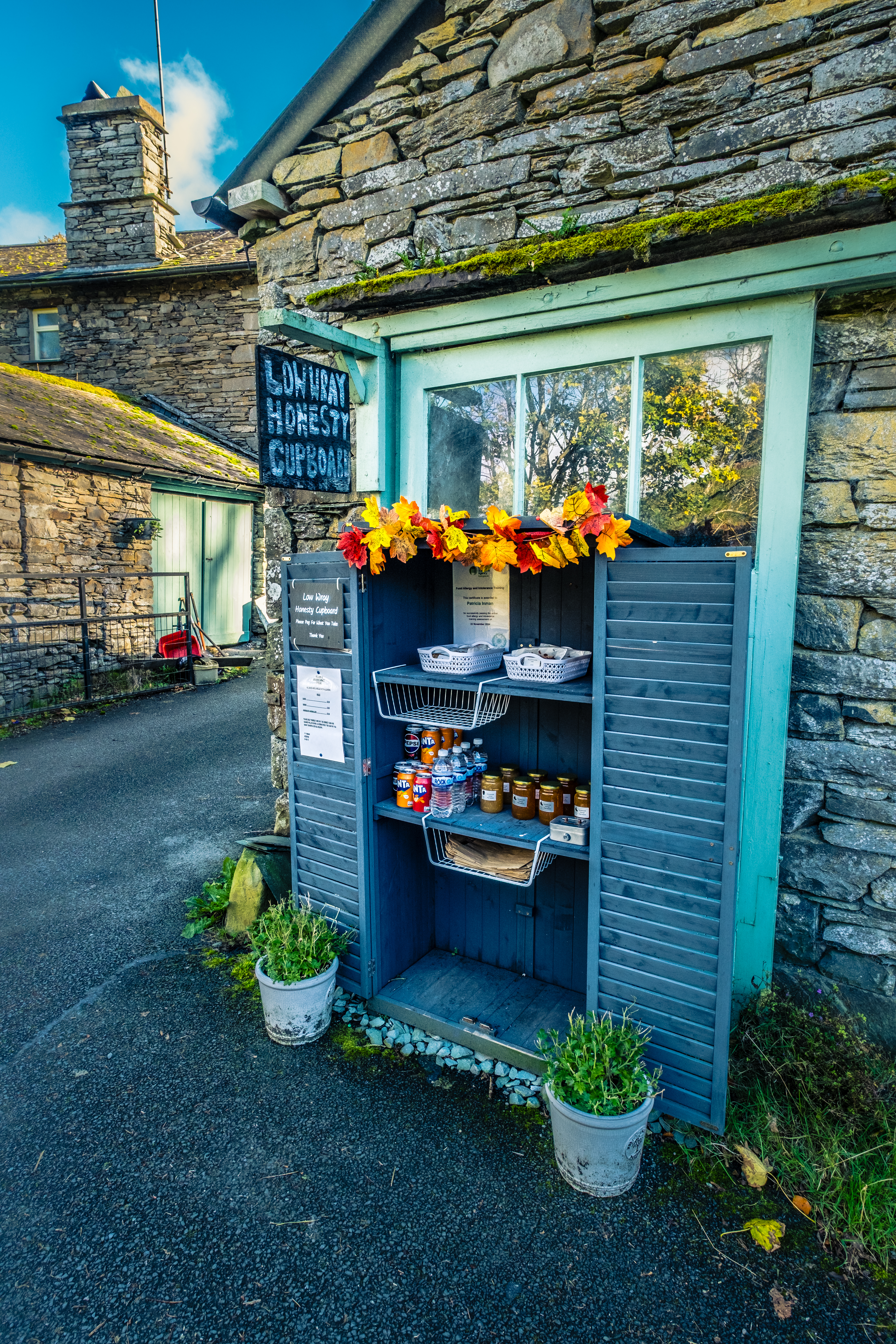
The car park is now a pay and display. Back in the day before parking fees were introduced I always enjoyed putting a few quid into the honesty box at the entrance.
Over the bridge, stopping to look down into the crystal clear water, it’s time to head home as it were. Before going through the gate have a read of the info boards and signs. Even a quick sit on the ‘made to last’ Victoria Regina 1897 metal bench is permissible.
Trending South like a flock of geese …
It’s immediately clear that we are now on a different type of walking track. None of the skimpy sheep trods and swerving around trees, this is unadulterated farm lane material. Consequently you can walk along with your eyes wide open because you are very unlikely to be tripped up by a tree root. Nevertheless as the walk goes on there is a steep banking down to the lake, so don’t slip there unless you have packed your swimming trunks.
The embryonic Goldrill Beck slithers quietly northwards on your left. For some quirky reason (maybe I think of the north as being up in the UK) it seems bizarre to have streams flowing northwards. Here you are likely to see numerous waterfowl splashing around, the ubiquitous mallards are always entertaining.
A number of years ago whilst ambling up this trail I noticed a grebe or merganser (can’t remember which species) towing some weed behind it as it swam upstream. Puzzled me how it was still moving effortlessly with such a handicap. The closer it swam the more bizarre things appeared. The bird then paddled across to the far bank as a few small clumps fell off the trailing weed. Then to defy logic the clumps began to swim … chicks!! Of course I was thrilled to see it wasn’t a mass of tangled weed. The chicks proceeded to pop up into the feathers of the parent bird and travelled majestically upstream like a load tourists on a lake steamer. Until … without so much as a peep, the parent dived, obviously spotting a tasty morsel underwater. All the chicks remained on the surface and scampered off to the far river bank to wait until the parent reappeared to load them up again.
Brock Crag over Goldrill Beck
Brock Crag – The Knott (distant) – Gray Crag – Hartsop Dodd over Goldrill Beck
At this point you can slip down to a long pebbly beach. Standing on the stone, front of pic, offers excellent views across the river to the superb reed beds and the hills towering over Hartsop. The bracken in mid autumn with the still verdant green fields creating a patchwork quilt.
Also looking ahead southwards toward Kirkstone invites an exploration. It needs to be stated here that once you get to the end of this beach it is better to retrace your steps to this rock in the water and get back on the main track. The shoreline at the end of the beach becomes very tangled and difficult to navigate for some distance.
Back on Track – Sauntering down the side of the lake is perfect. The deciduous woodland forms an intricate branch tunnel, glimpses of the lake and surrounding mountains are fascinating. The steep slopes on your right encompass a full range of native trees, ferns and mosses. Soak it all in and listen out for flocks of geese migrating south just before winter kicks in. Luck be on your side if they decide to zoom down and skid across the surface of the water for a pit stop on their journey.
As you emerge from the trees the scene becomes more open with fields ahead and the perfect picnic spot beside the water sitting on springy turf. If you have delayed nosh gratification this is the place to fuel up and rest for a while.
Final Lap
Wandering off toward Hartsop Hall we find drystone field walls and plenty of sheep grazing peacefully. At the very tip of Brotherswater a spit of land (possibly man made) always has waterfowl resting and preening. A pair of resident swans, mallards and cormorants were in residence in this photo, far enough away to feel secure from the visitors who have begun appearing in numbers as we get closer to the campsite.
Through the final gate we approach the farm which is circumnavigated before we head out on a sealed farm road to Sykeside camping area.
Some new mountains are showing as we come to the Hall. From this low angle the hills look mightily impressive. The valley floor is flat and the ridges start without much preamble. We are also seeing more people wandering around.
Middle Dodd – High Hartsop Dodd
Hartsop Hall is a superb old building owned by the National Trust. Constructed in the 16th century and Grade 1 listed. It’s a working farm with a large flock of mostly Swaledale sheep ranging around the 3,000 acres. I always enjoy being here because there are several options for walkers. Northwards to Brotherswater you have just travelled around. West to Dovedale, which I consider to be the most magical valley and another path going south over to Caiston Beck before branching up Kirkstone Beck then up to Kirkstone Pass.
Kirkstone Beck and Middle Dodd
Hartsop Hall
Finally we move through the campsite, loads of folk enjoying themselves, happy smiling faces. You can’t blame anyone for wanting to stay on this site, it’s ideal for exploring the area. If you do stay there look up to the towering slopes of Hartsop Dodd to the east early in the morning. I have seen red deer grazing there many times.
A few hundred metres more past the shop/reception building we trundle up the slope to the Brotherswater Inn. Difficult not to stop there for a cold drink before scooting back through the rough fields on the east side of the Kirkstone Pass road to your vehicle.
That folks is it. I have certainly enjoyed writing this blog, and my hope is that you have enjoyed reading. Keep smiling, see you again very soon. John
Over the years I have spent many a day solo walking the hills. During the early climbs my aim was to get as high as possible as quickly as possible, then savour the ridges and vast space of the mountain tops. To do that I needed to get into a walking rhythm and I was very mindful of where I was placing my feet, a stumble in those days was grounds for divorce. So I would think about the structure of my body, how it was in balance, despite carrying a heavy backpack, and judged the nature of each piece of earth. I learnt how to gauge and traverse steep slopes on different stones, grass, scree, boulders by paying close attention to my legs and particularly to my feet. My boots became an extension of my body. My first pair of walking boots were Scarpa Monte Rosas and they were wonderful, double skin leather that moulded to the shape of my feet.
Once my mind was feeling connected to the terrain I moved almost effortlessly. Being able to spring from rock to rock and push hard uphill became natural and I would enter a flow state where every part of my body was functioning to a high degree of precision. Sometimes whilst immersed in this flow state I would stop and be quite stunned how far and high I had travelled. Enthusiastically I would look forward to further progression, eager to see beyond the summit.
Nowadays I have to be slow, ankle joints wrecked with osteoarthritis. Thankfully I can still walk carefully, perhaps even more carefully because I can’t afford to fall. This means spending more time looking down than up as I progress, and guess what. It’s bloody marvellous! I see so much more of the land I am covering, and stop over and over just to look at some colourful rocks, or tiny flowers, grass seeds and animal tracks. Truth be told I take just as much delight in every step now as I did in my heyday each time I ticked off another summit.
Walking is my joy and I hope that anyone who becomes unable to walk far can find some connection in these blogs.